

A walk back through time, with one of today's premier D-Day experts...

That expert being our Gen Z son. Whoever said Gen Z doesn’t care about history was definitely wrong in this case. I could spend all day explaining why our son is on the cutting edge of current day research into the Normandy Invasion, codename Operation Neptune, but I’ll let his own work and words do that job.
CLICK HERE TO VIEW THE RESULT OF NEARLY THREE YEARS OF RESEARCH INTO THE OMAHA BEACH LANDINGS.
Everything you’ll see on our son’s site was created from scratch by a Gen Z Computer Science major and Classics Minor (don’t ask!)

Amazing enough, but this post is about so much more. I recently returned from a once-in-a-lifetime trip with our son to visit Omaha Beach and many of the historic Normandy Invasion sites in the area.
This wasn’t the “usual” tour, which would have been incredible enough. Our son took me on a comprehensive exploration of the area, which involved—a fair amount of trespassing—to reach sites and fortifications that go mostly unseen by visitors, but are known to him through his research. And a little Google Map exploration.
I wanted to share pictures of both the “usual” sites (which are still surreal) and the places that required some extra effort—and an “I’m sure they won’t mind if we walk across their property” mindset.
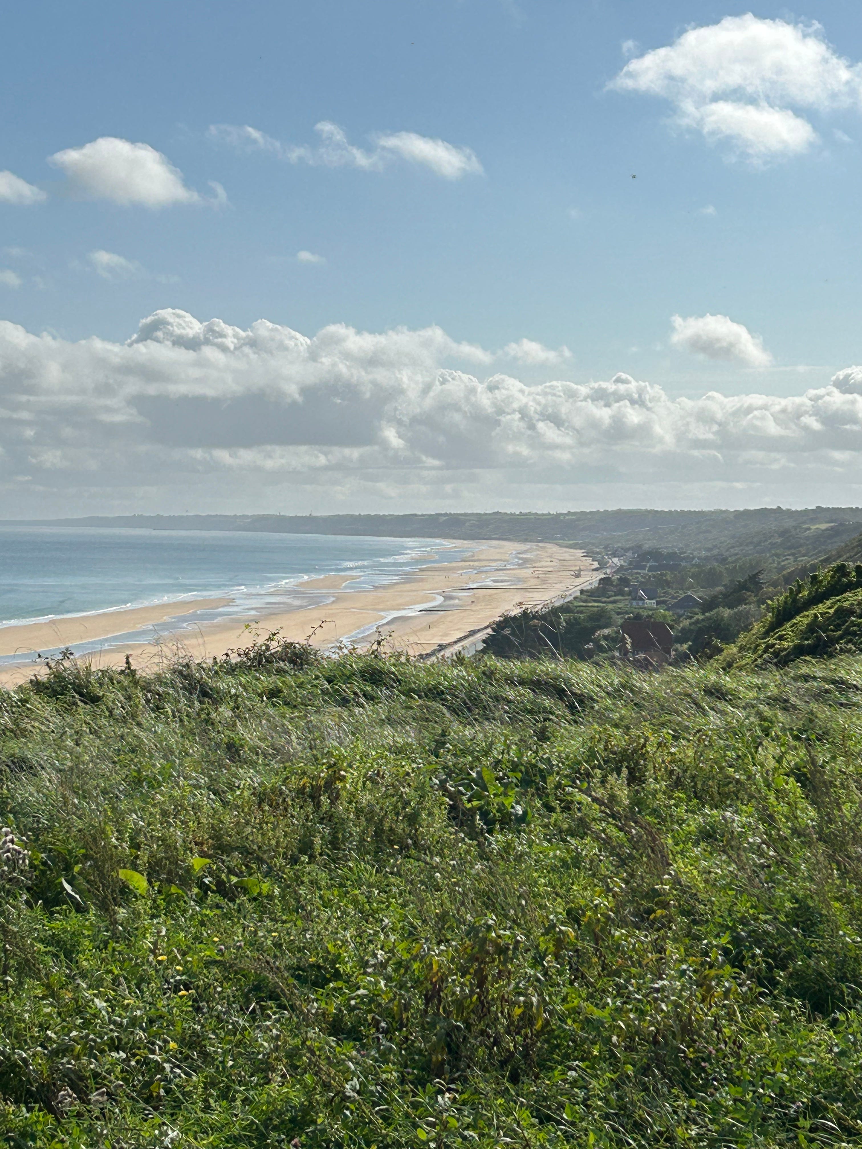
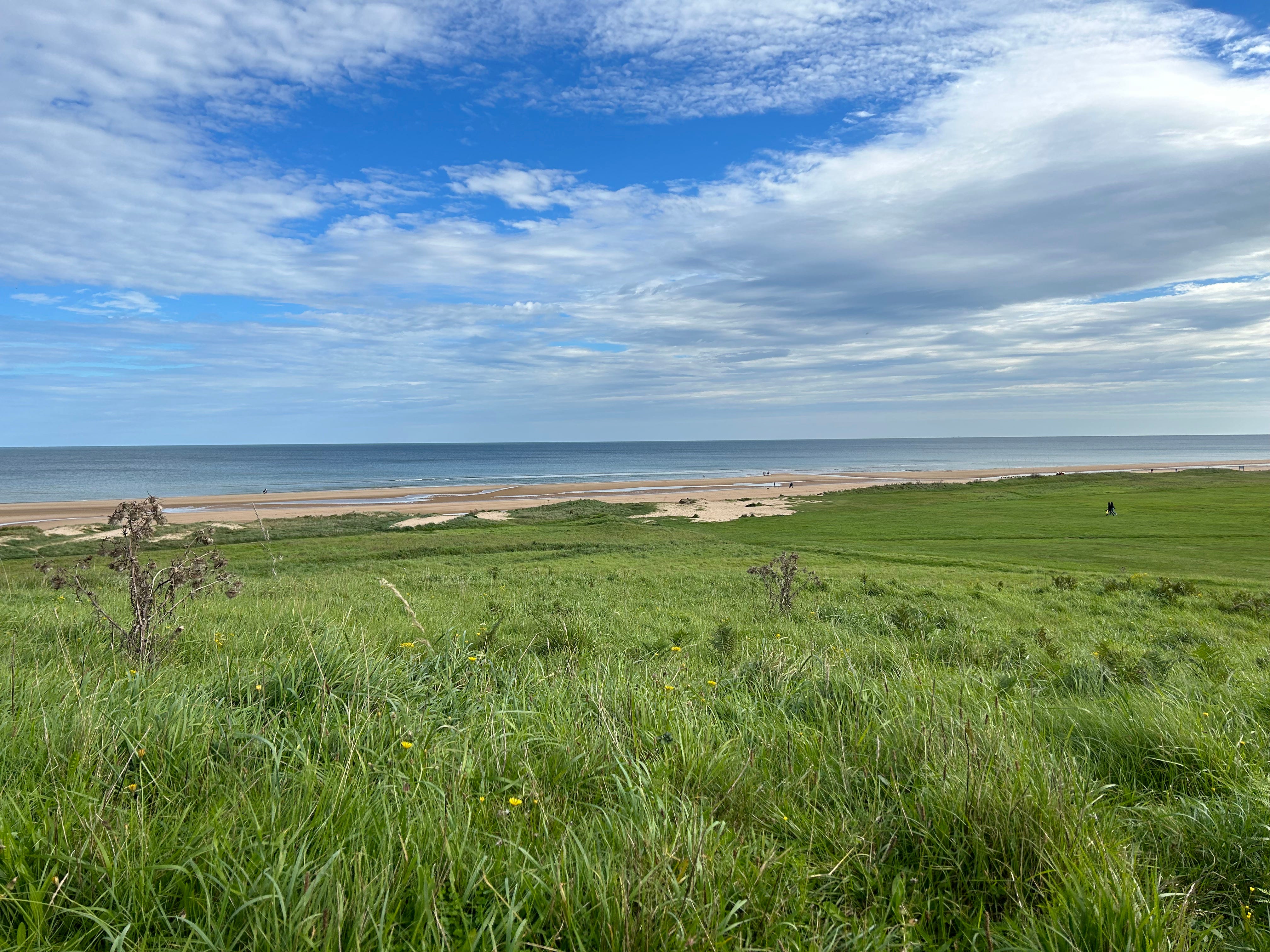
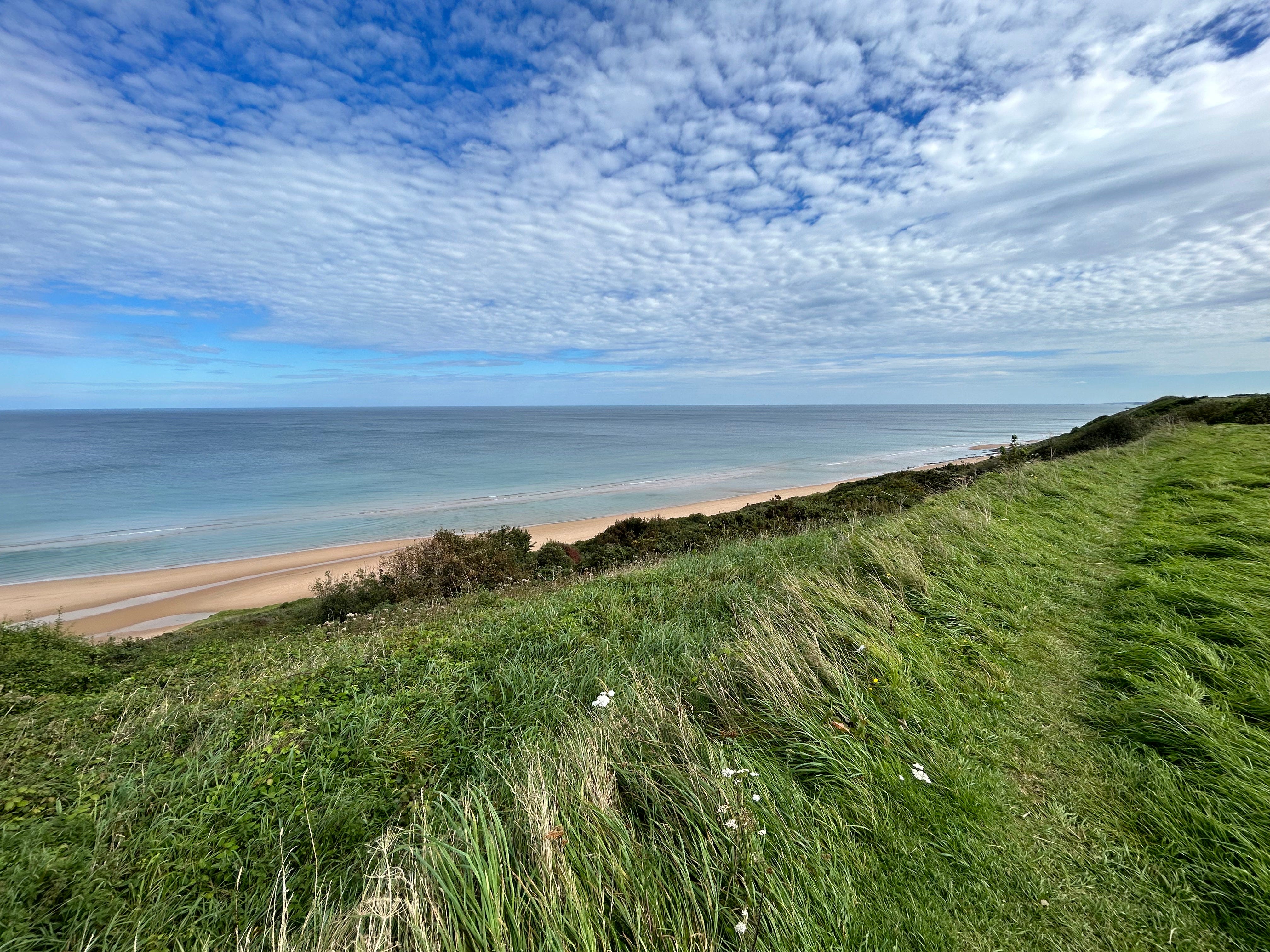
The most unusual aspect of our visit was the serenity and beauty of the area. It might be one of the most picturesque places I’ve ever visited. The beach is stunning. The surrounding lands pastoral and seemingly unchanged over time. Driving between the beach and parachute landing zones, you almost forget “when” you’re here. Stone churches and stone farmhouses line the narrow roads throughout the area.
It’s hard to reconcile the peace and tranquility of today’s Normandy Beach area with the past. But you could feel the heavy weight of the region’s history—with every footstep.
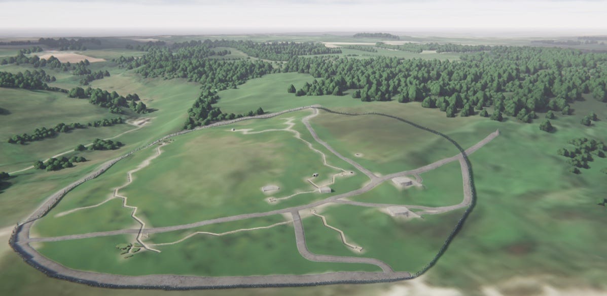
Where to start? Here’s a picture taken shortly after the beaches were taken. Point du Hoc, the German artillery battery that could range all of the beaches, is located a few miles to the left (west)…out of this picture.
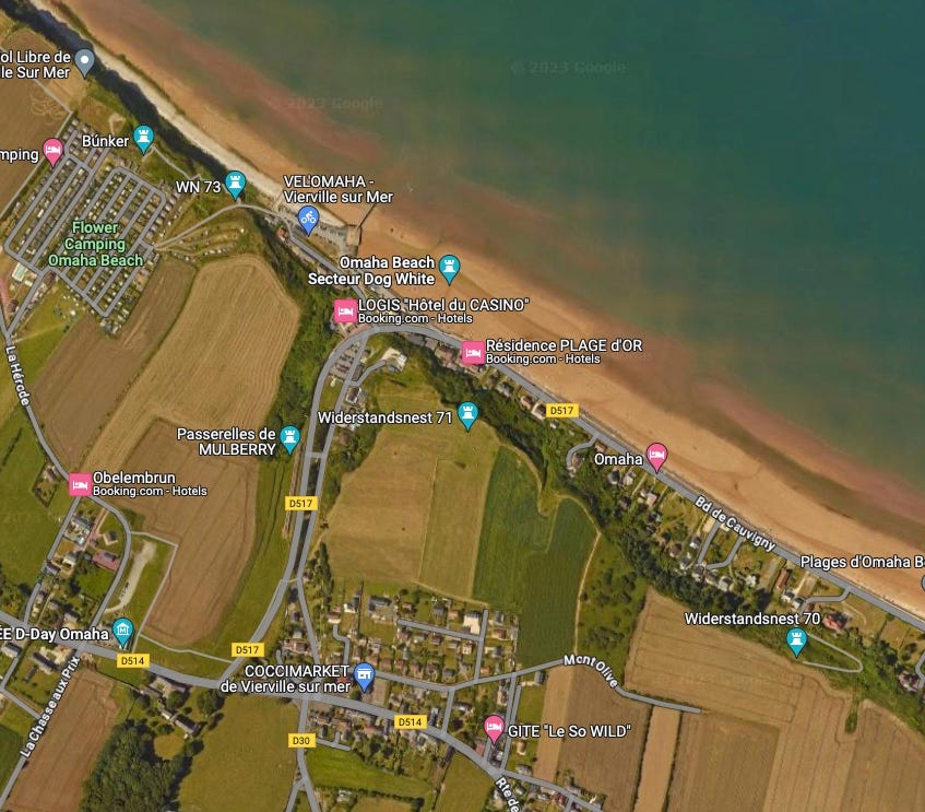
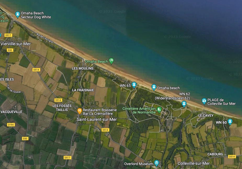
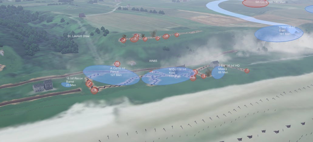
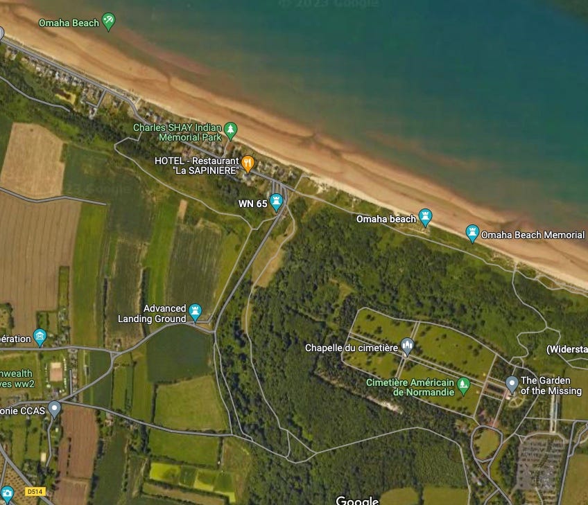
I’ll use this image to give you an overall orientation of the sites described, screenshots from our son’s project for historical context, along with current day Google Map imagery—to explain our journey through the various draws used by American forces to punch through the German defense networks known as Widerstandnests (WN- “nests of resistance) and secure the Omaha Beach area.
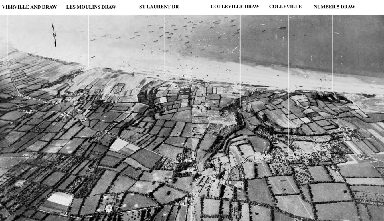
ANOTHER REFERENCE MAP (All landing zone designations)

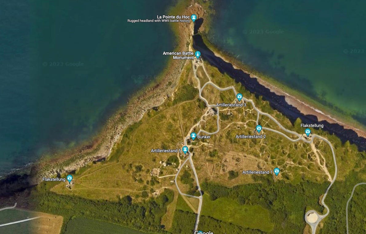
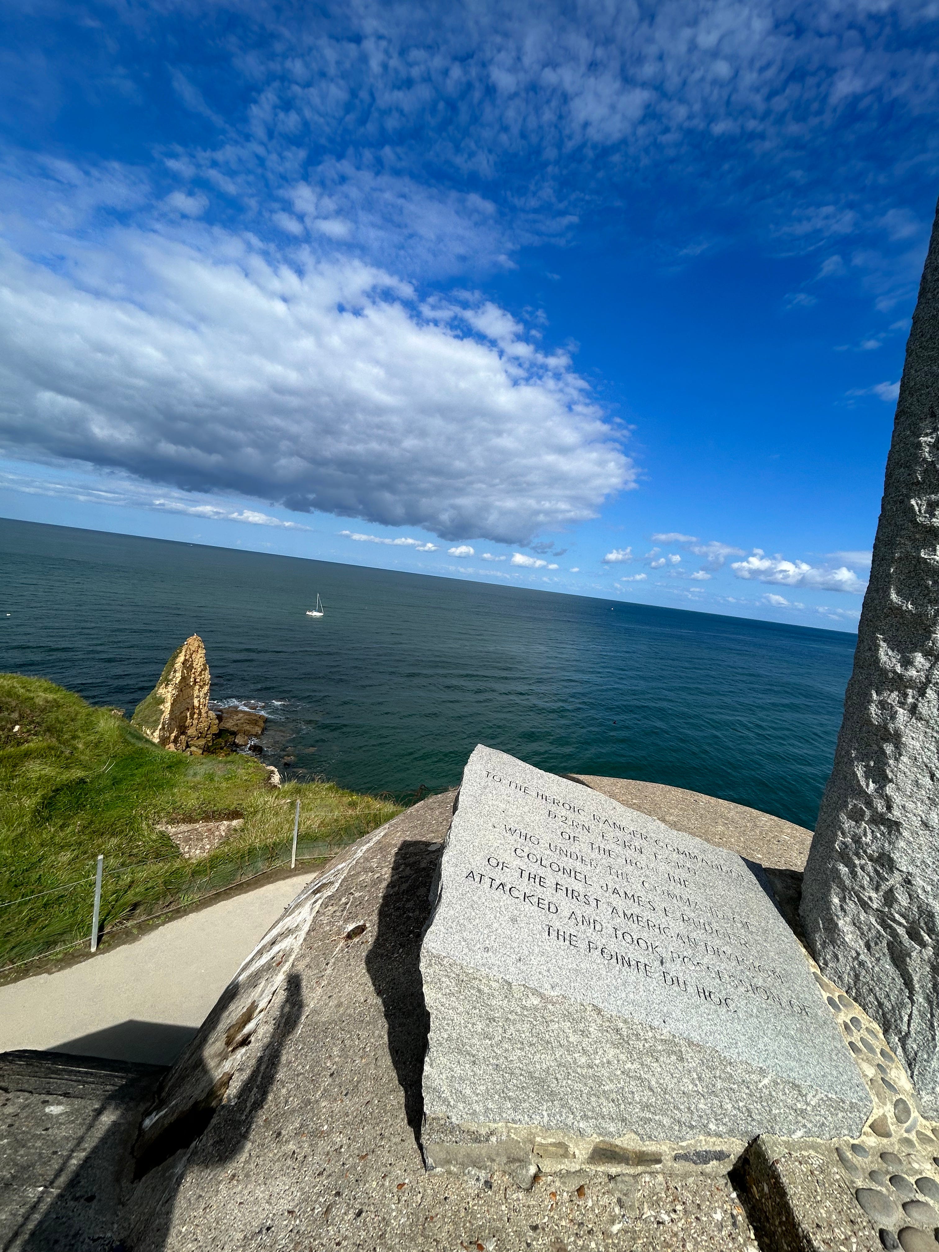
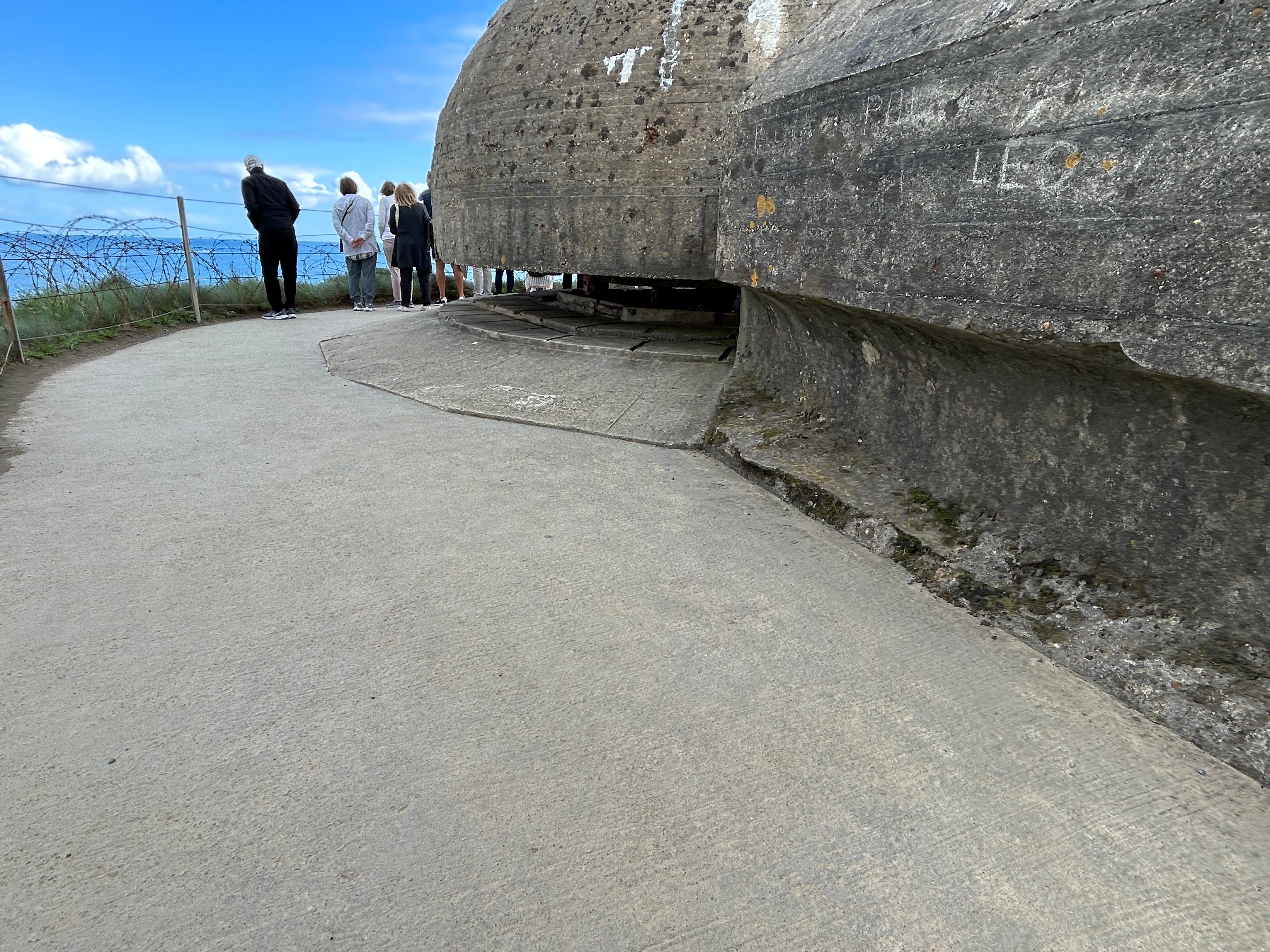
POINTE DU HOC:
We visited Pointe du Hoc on our first day in Normandy, after taking the train from Paris to Caen, where we rented a car. I based us in Bayeux, which is no more than 15-20 minutes from any of the major Omaha Beach sites. And Bayeux features both a UNESCO designated church and the Bayeux tapestry, also a UNESCO designated work. Not a bad place to retire to every day…and the town is picturesque.
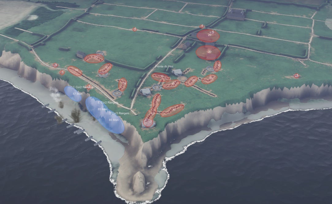
Pointe du Hoc is a well preserved, maintained and presented fortification site. You can walk most of it along well groomed paths, accessing the interior of many bunkers. The guns at Point du Hoc could fire on Omaha Beach, several miles away, and potential boat off-loading points to the west. 2nd Ranger Battalion scaled the cliffs below the site and swiftly overwhelmed German defenses, only to find that the guns had been moved further inland. They located and destroyed the guns a few hours later, but were forced to retreat by a German counter-attack. The Rangers held the site for two days, awaiting reinforcements, which were bogged down by heavy German resistance to the east.
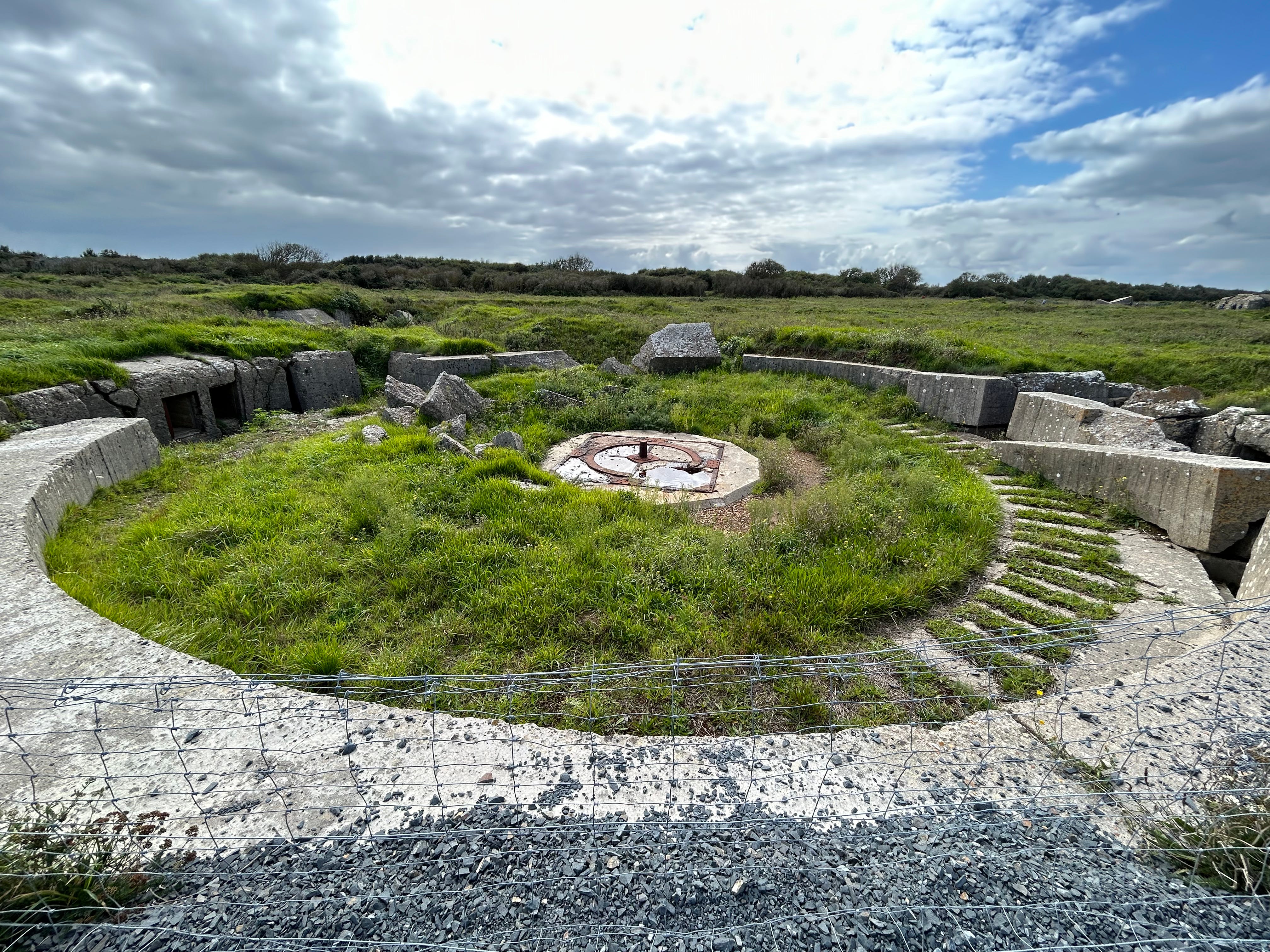
Open field gun emplacement.
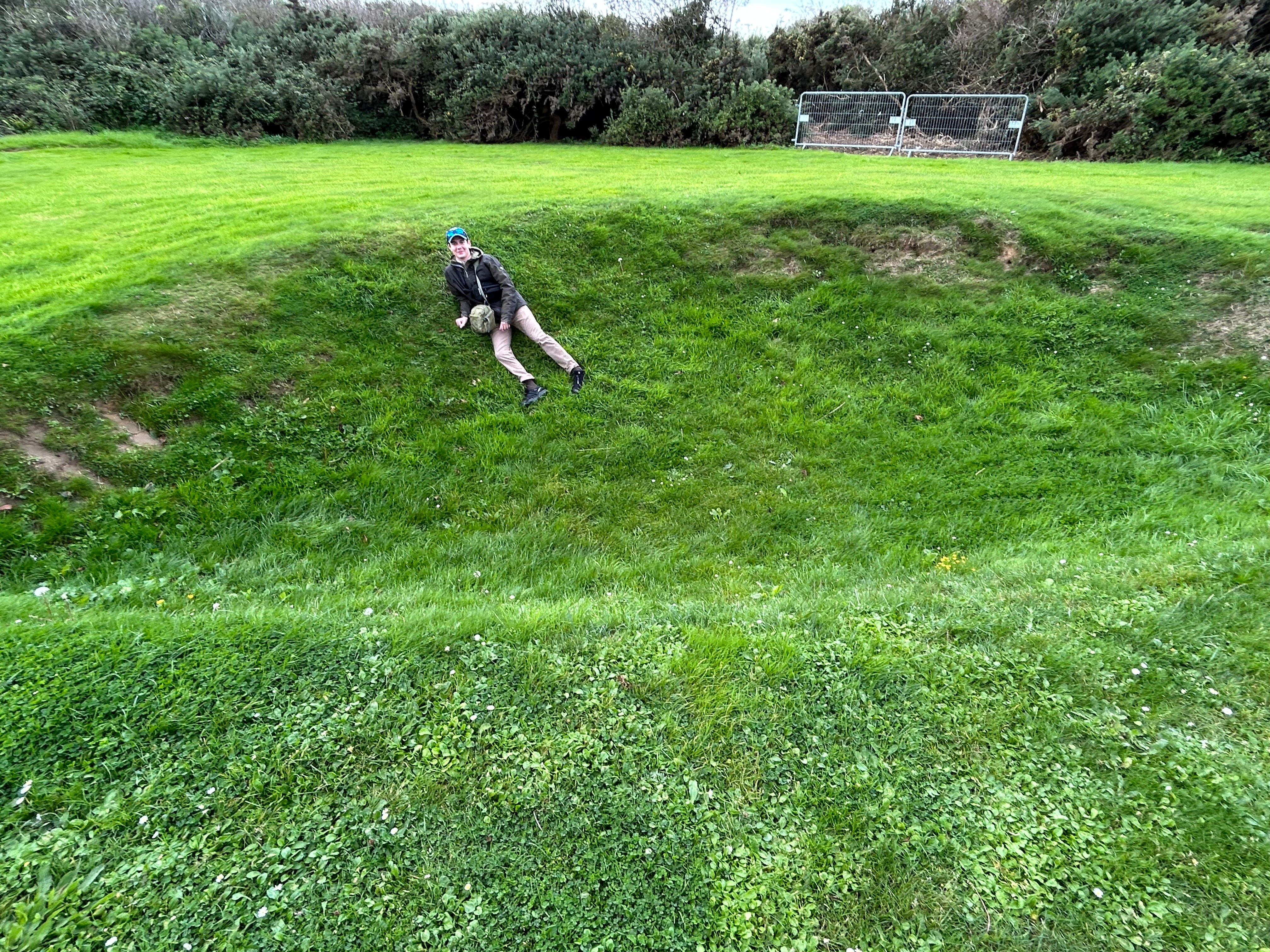
This is one of the craters created by the allied bombardment the day before D-Day. Incredibly, none of the gun emplacements were hit by the massive bombardment.
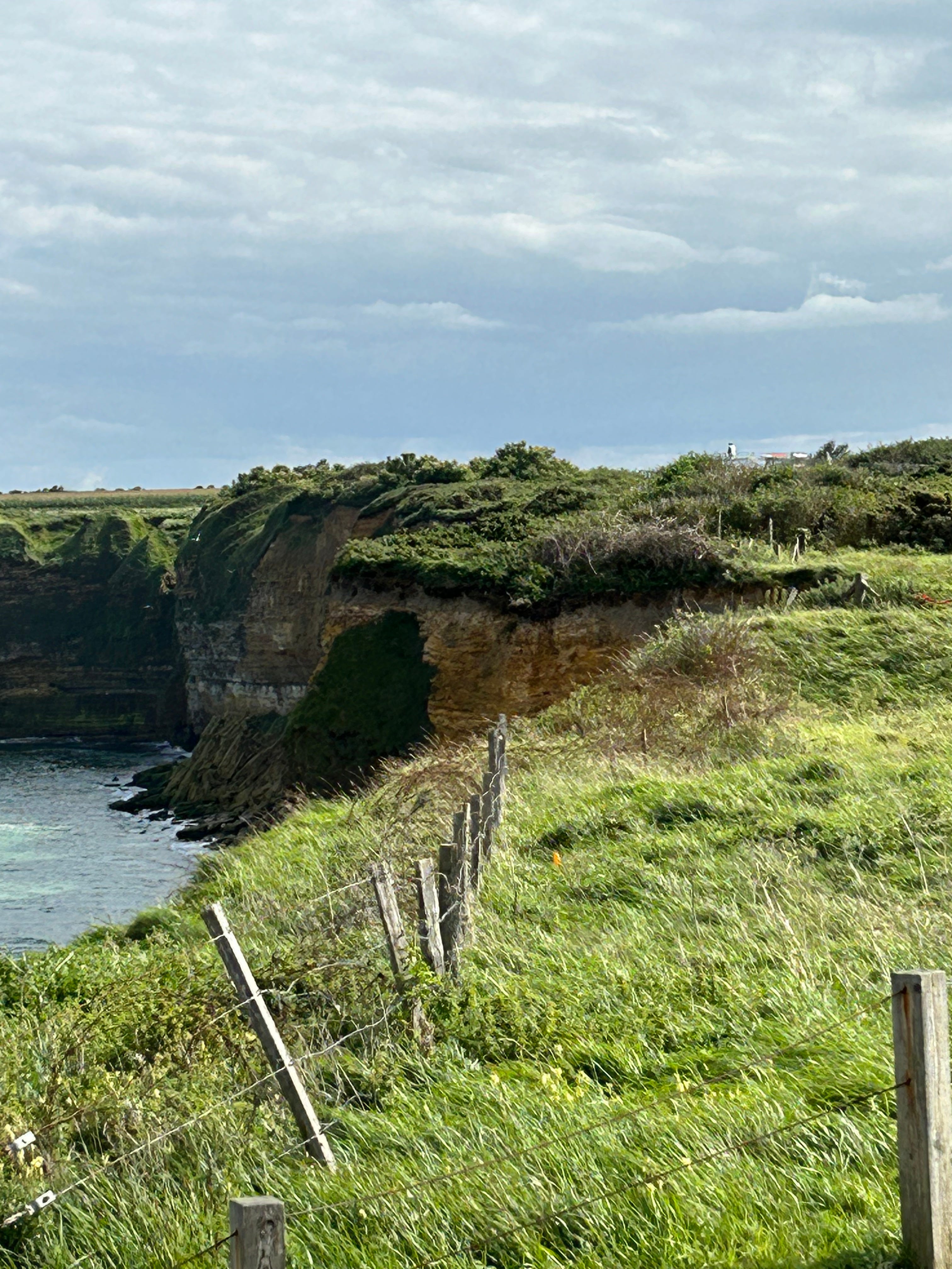
This is a view of the cliff’s scaled by the Rangers, located almost directly under the point, just to the east.
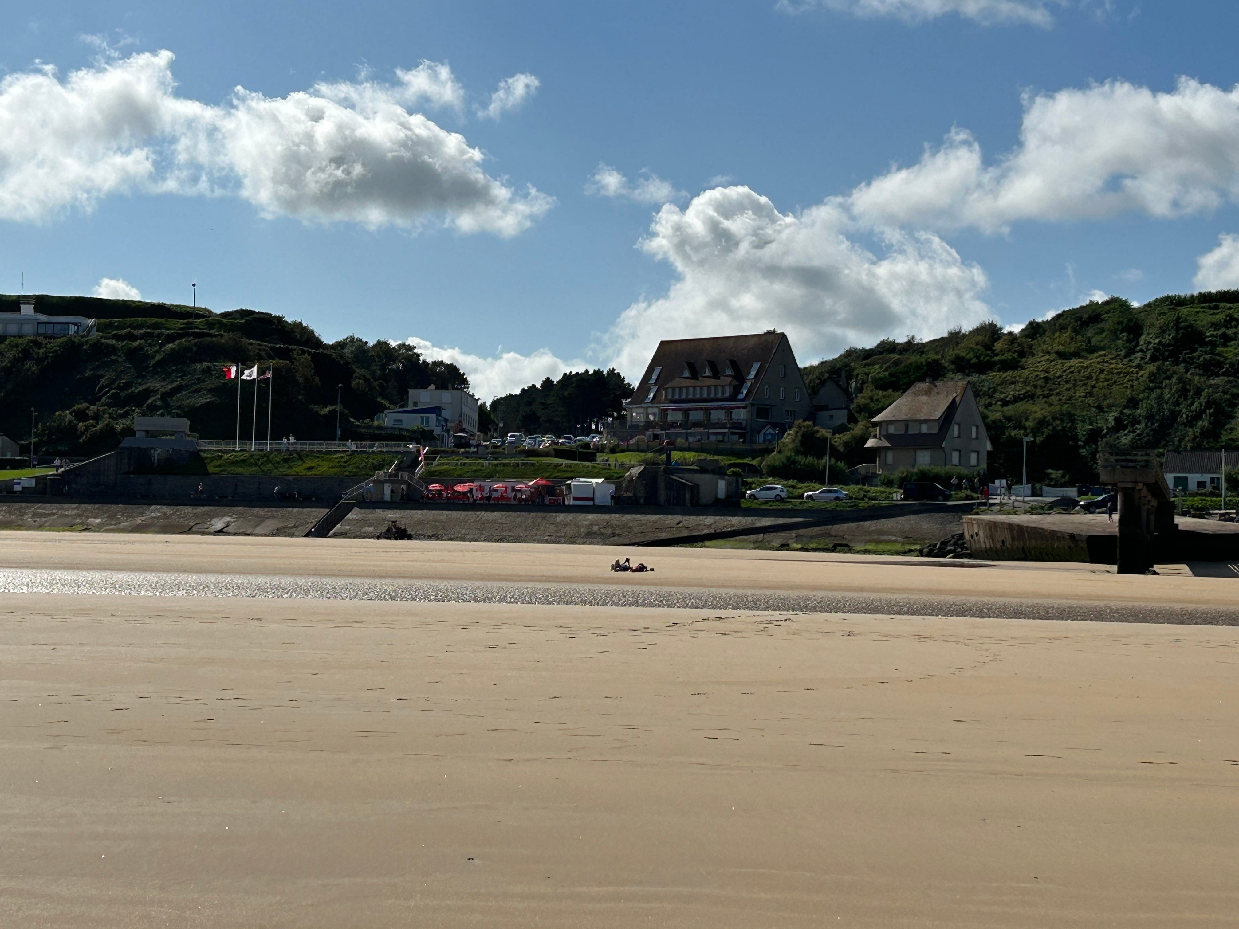
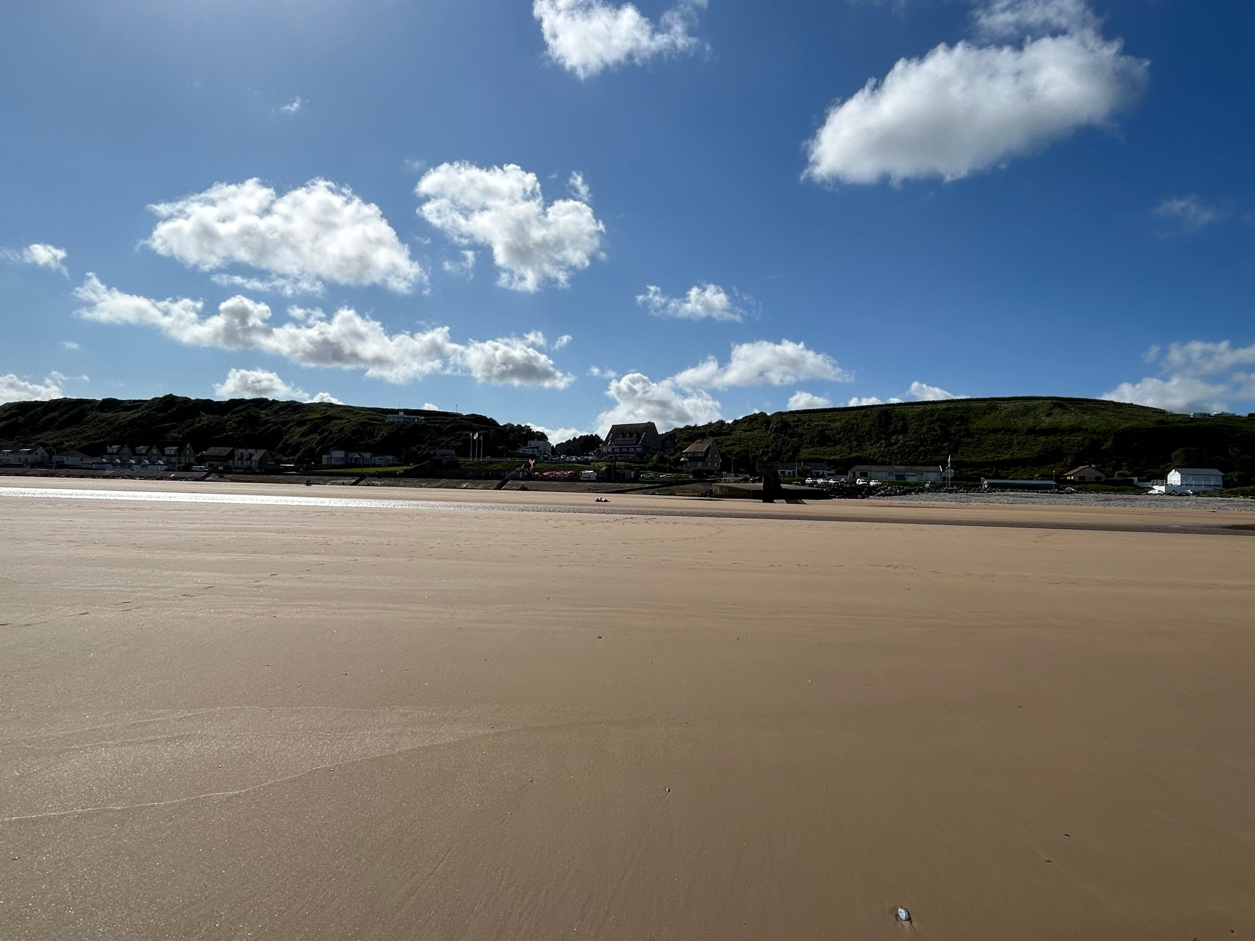
VIERVILLE DRAW:
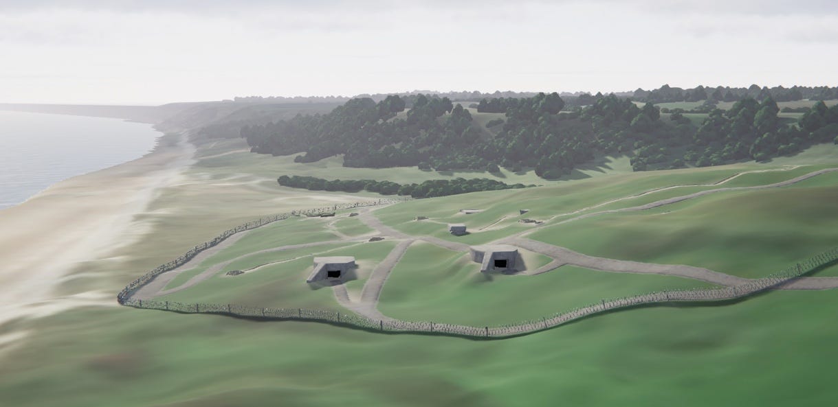
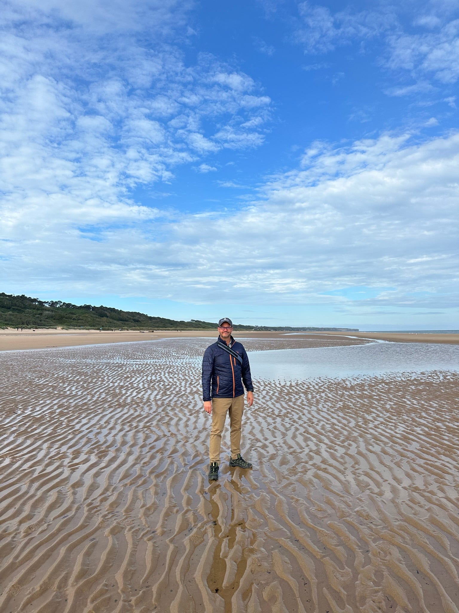
The draw (opening from the beach to interior lands) here was a little commercialized (A LOT, actually). Standing on the beach, it was hard to conceptualize that this draw was the most difficult for Americans to breach. The opening beach landing scene from Saving Private Ryan took place right here, at Dog Green Sector. The massive machine gun bunkers in the movie did not exist…the Rangers’ biggest risk at first would have been artillery fire and rifle or machine gun fire from the trenches along the beach.
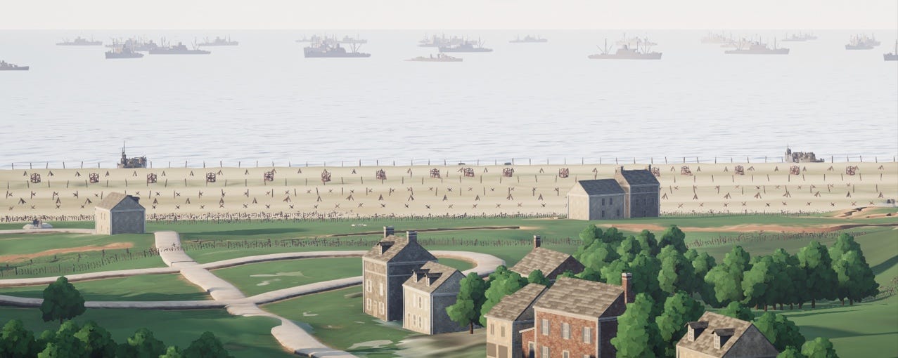
But once they pushed inland a few hundred yards, they would have been subjected to the kind of brutal machine fire depicted in the movie. It’s difficult to tell from this image, but the hills on both sides of the draw had been fully fortified with machine gun nests that fired into the gulley leading out of the beach. All of those sites are overgrown and inaccessible.
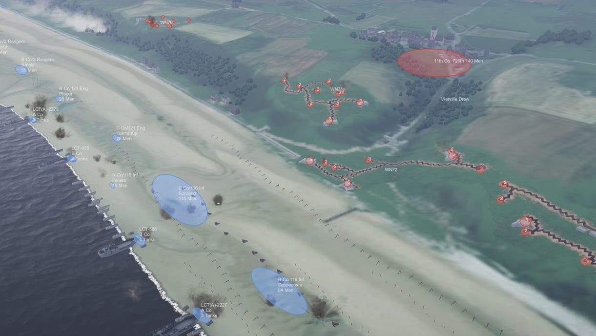
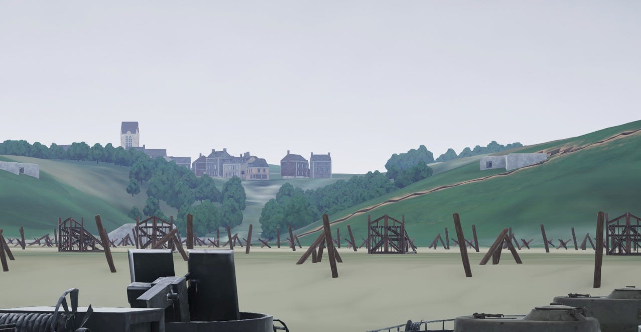
Above is what it looks like today. Below is what it would have looked like on D-Day (screenshot taken from our son’s project)
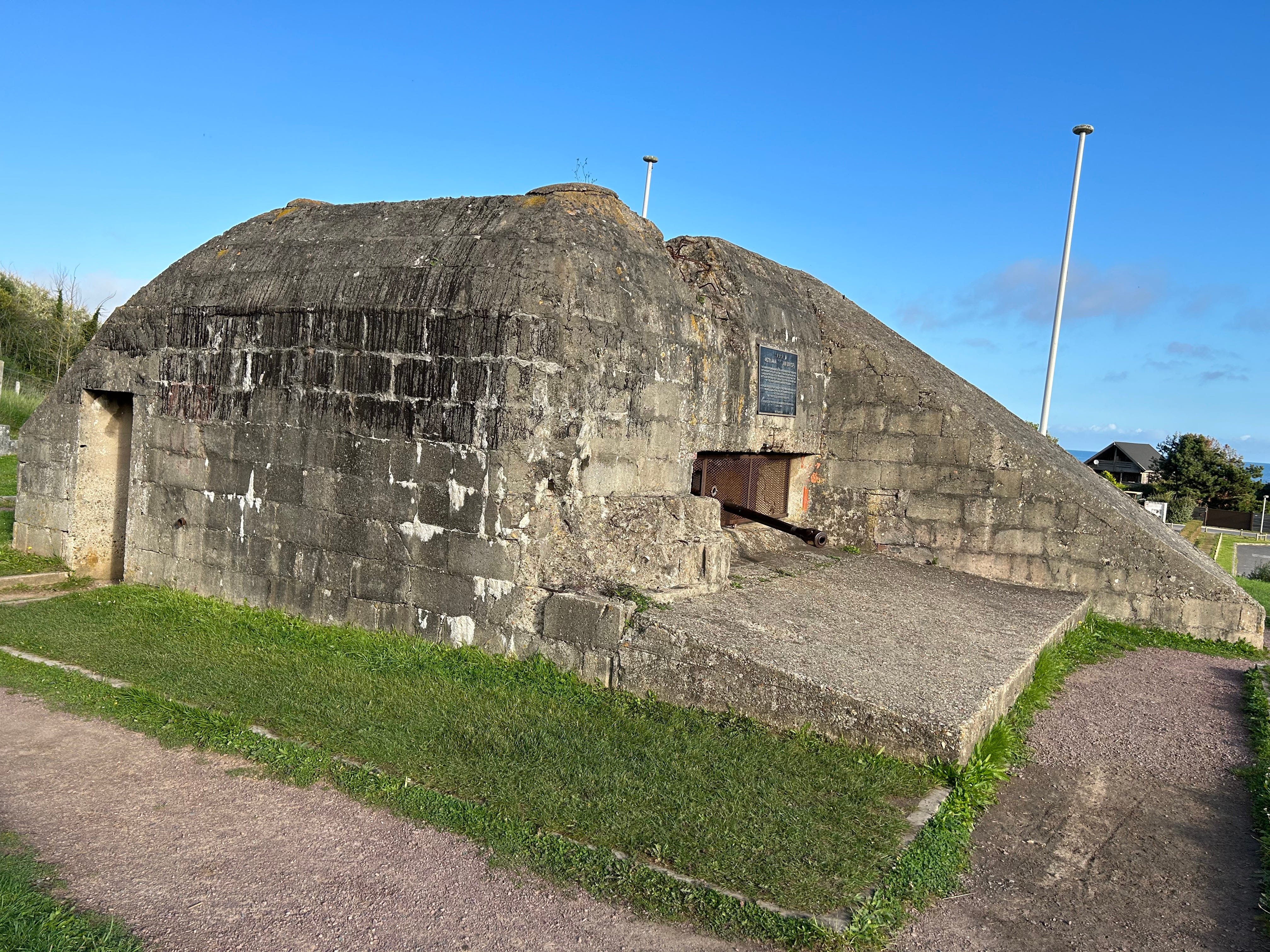
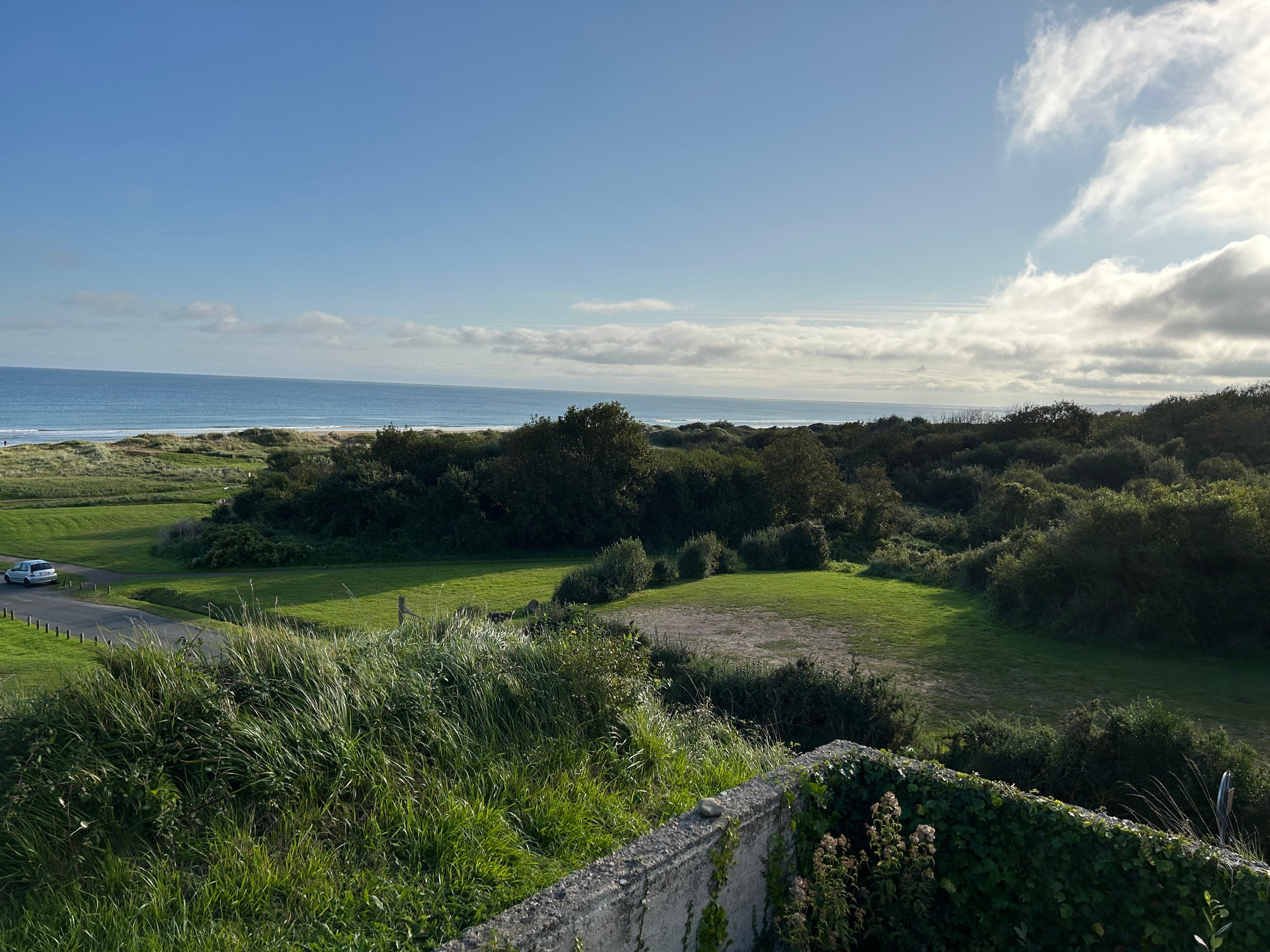
We did find a few easily identifiable artillery fortifications in the hills on the western side (88mm Flak gun emplacement, used against beach targets).
Above is the view from that gun emplacement.
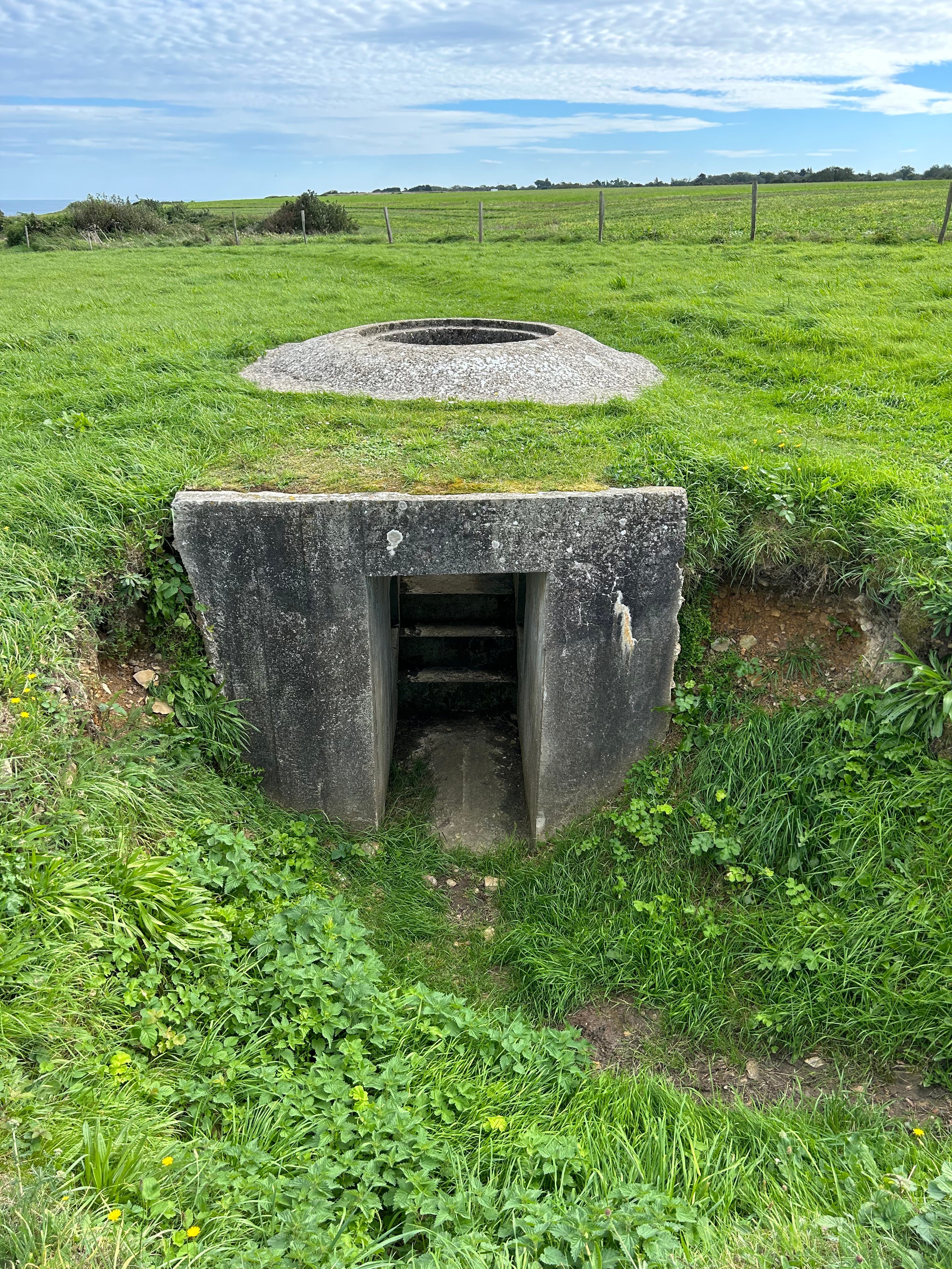
We also travelled well off the beaten path and found a machine gun “Tobruk” in the farm fields to the east, where WN70 had been located. A Tobruk is an in-ground fortification, connected to trenches. The Germans fired mortars out of them, or mounted MG34 machine guns on swivels to cover the ground over their trenches. These guns did not fire down onto the beach (defensive only), but the mortars did.
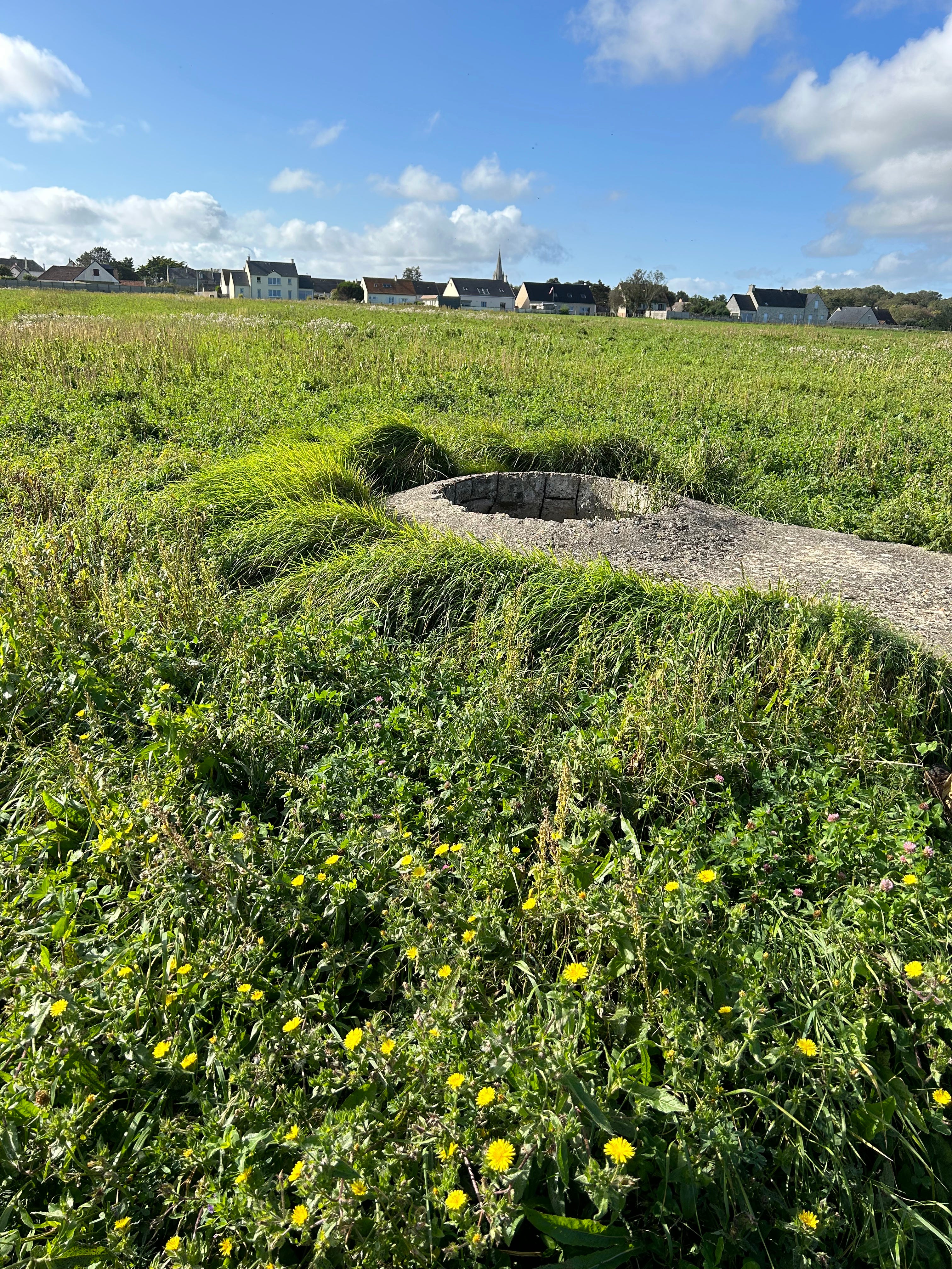
This is the view from the general area of the machine gun emplacement.
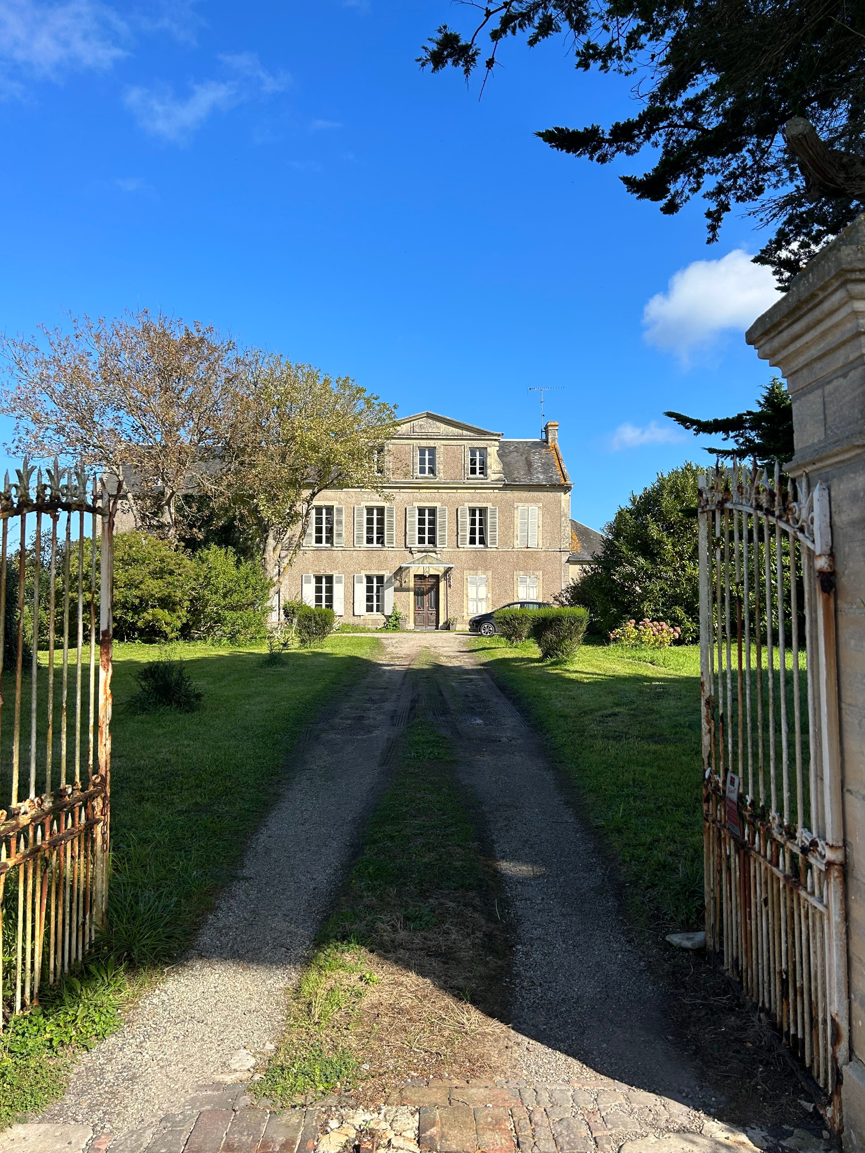
We walked through a half-mile of fields to reach the MG Tobruk, then cut straight through another field to reach a small road that led us through the actual village of Vierville and back to the beach.
Here’s a chateau we passed along the way.
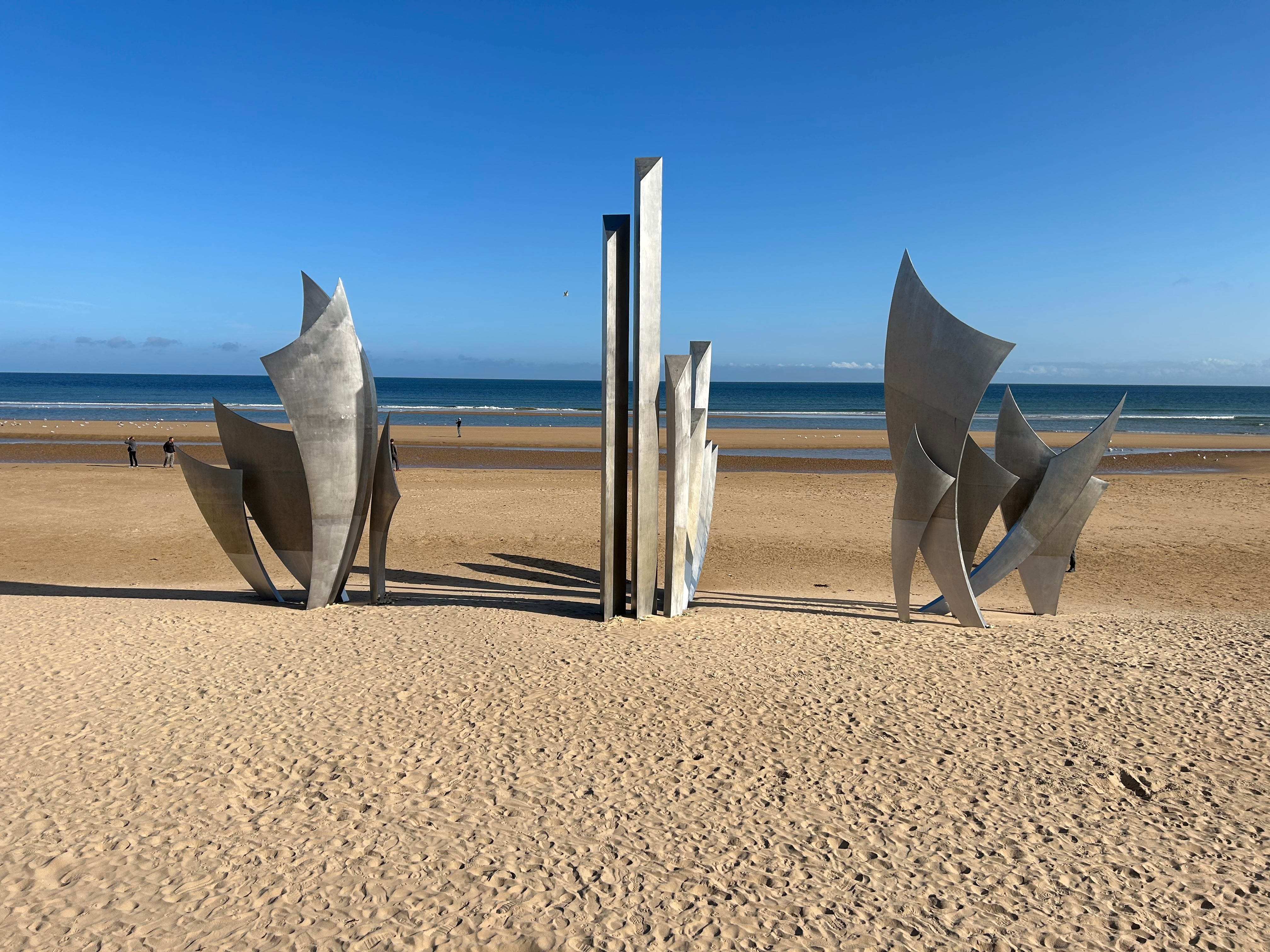
LES MOULINS DRAW:
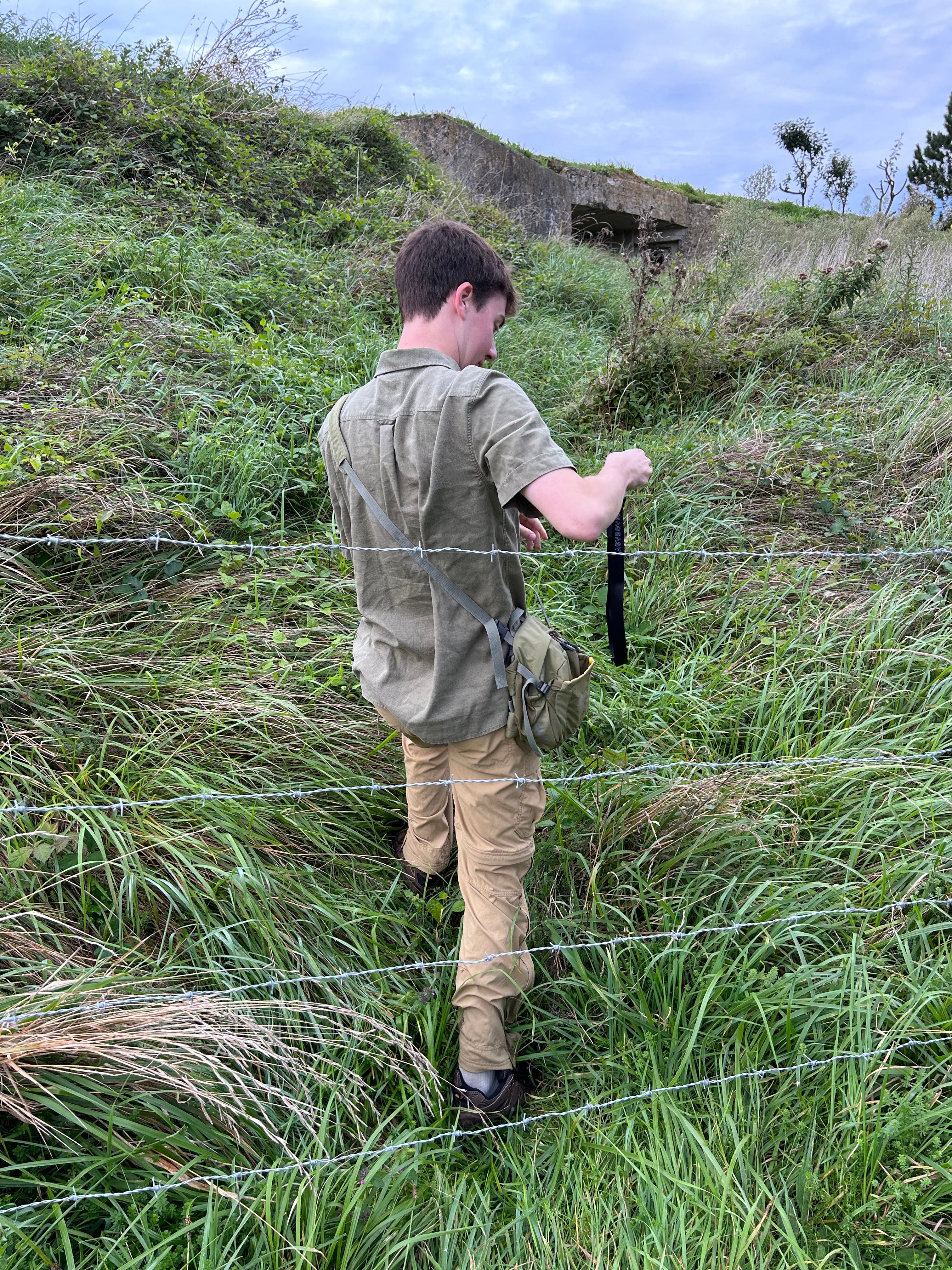
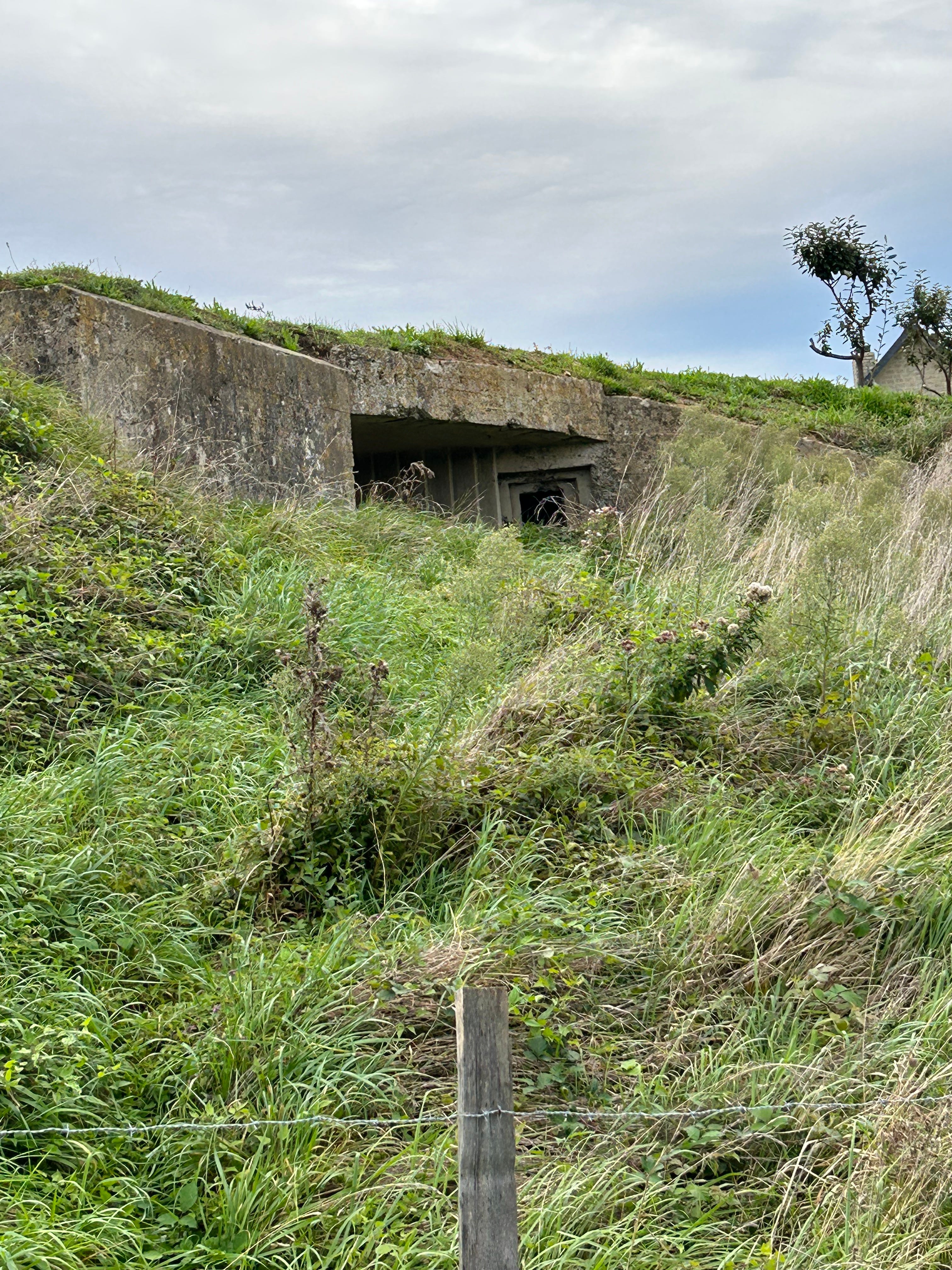
Les Moulins is the most common tourist stop, and features the main beach memorial. Like Vierville, there’s not much to see here. Don’t worry, the sites get far more interesting. Still, just standing here and taking in the echoes of history was breathtaking. And we did find a double machine gun bunker up one of the roads on private property, along the western edge of the draw. I did the right thing and held the barbed wire up while our son crawled under and explored. I was the lookout.
The memorial is right on the beach.
SAINT-LAURENT DRAW:
This draw is fairly small, but gave us plenty to explore. First, there’s a gun emplacement next to the main parking lot, along with some fortifications to observe (explore at your own risk). The views from this draw are stunning. We spent a lot of time just taking it all in.
COLLEVILE DRAW:
The Colleville Draw is the closest to the U.S. Cemetery. You can walk between the two.
This is the only picture of the cemetery that I took.
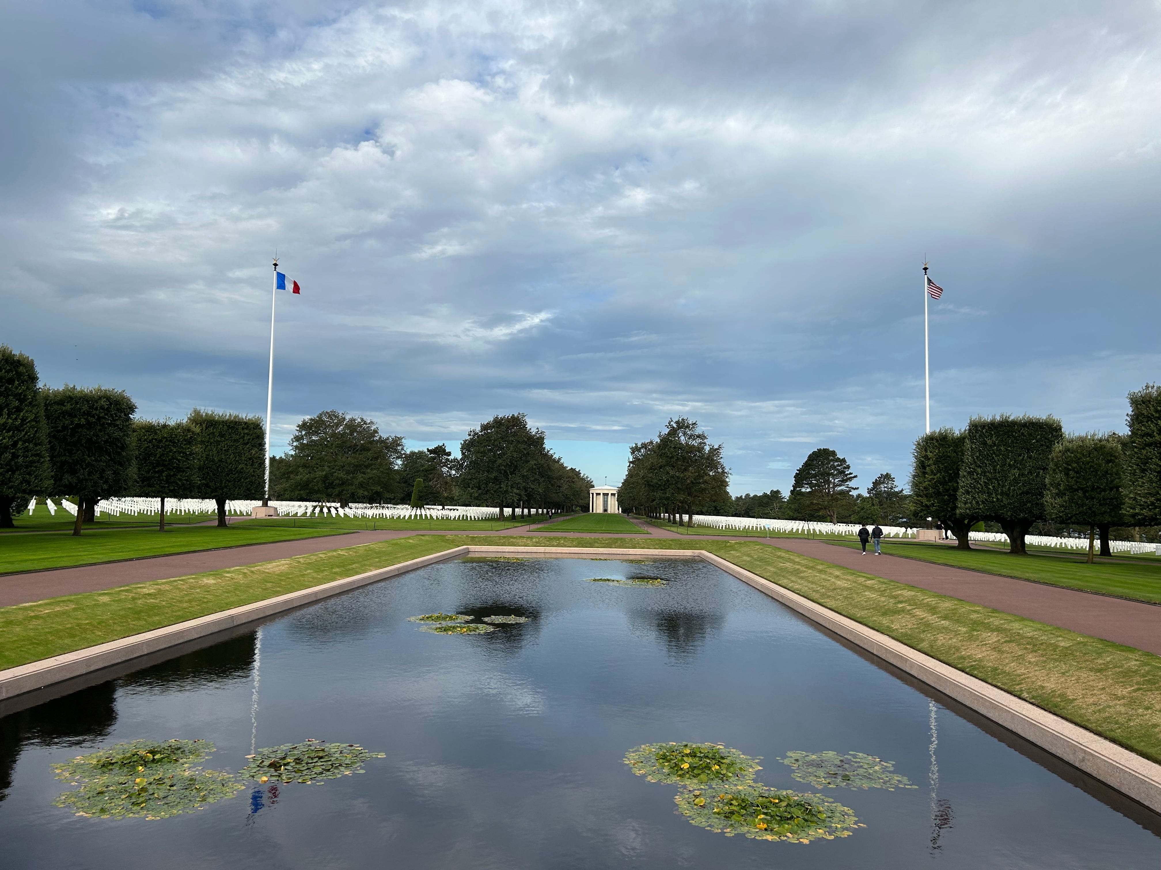
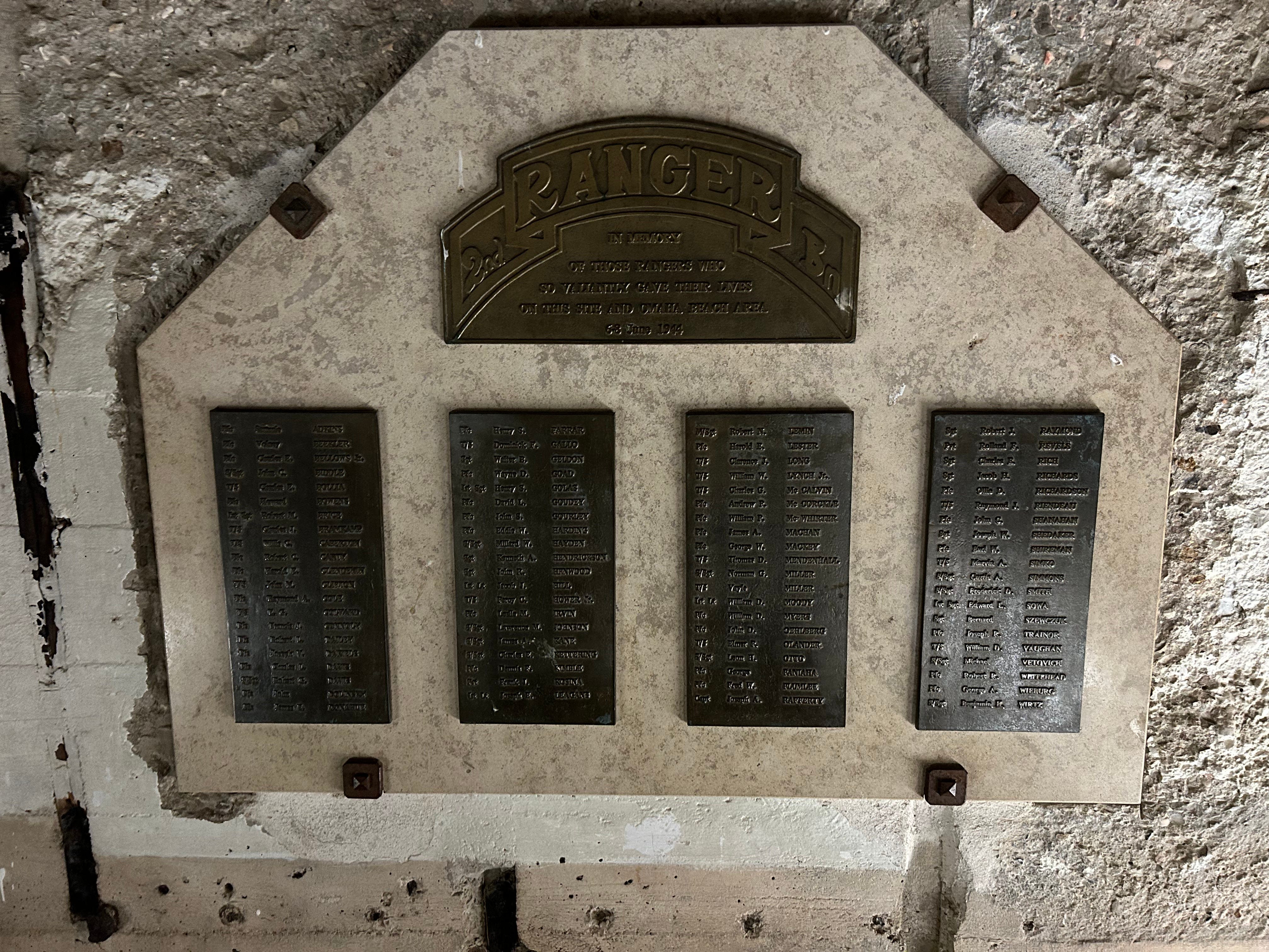
After paying our respects to the nearly 10,000 American service members buried at the cemetery, we headed to Colleville Draw. Colleville was a major beach landing site, heavily defended by two fortified defensive positions. WN62 and WN61. WN62 is the best preserved site on Omaha Beach, featuring a number of artillery bunkers, machine gun/mortar Tobruks, block houses, observation posts and still visible trench line (filled in, but you can see the zigzag patterns).
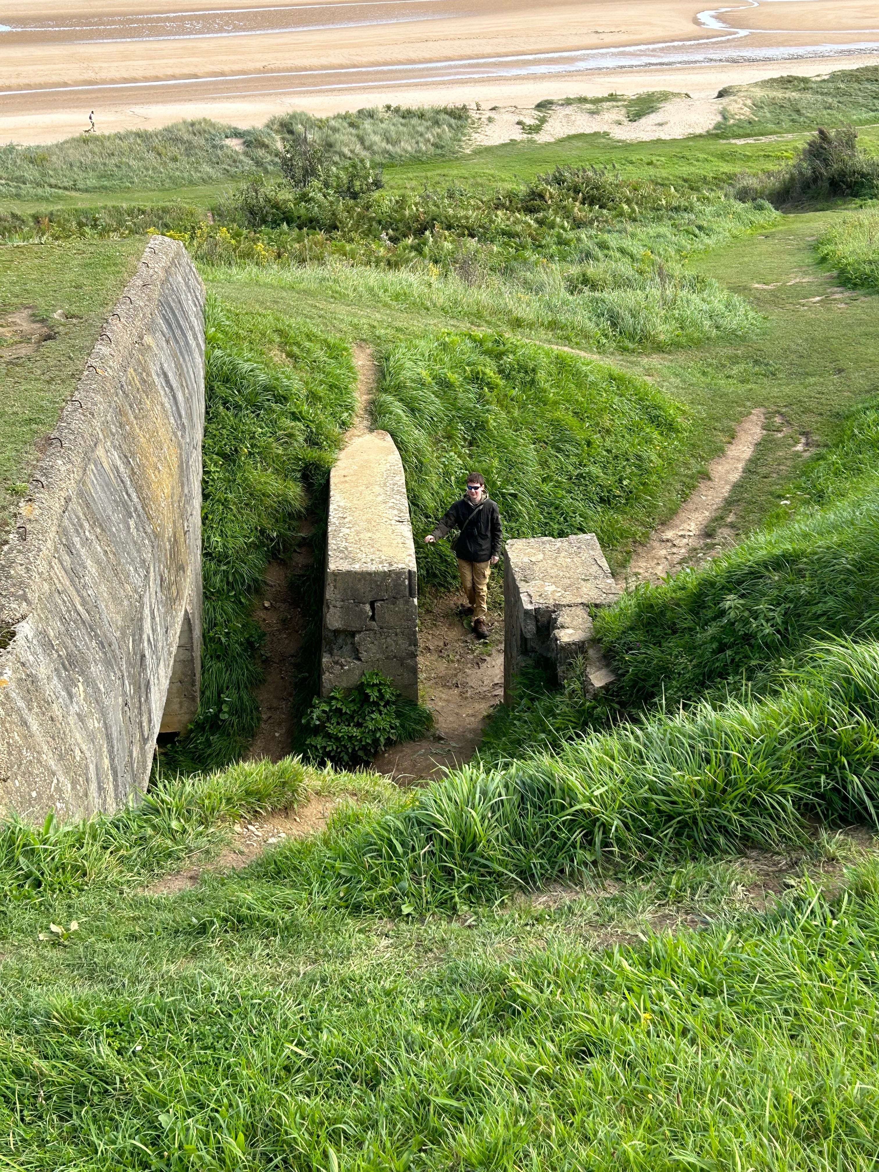
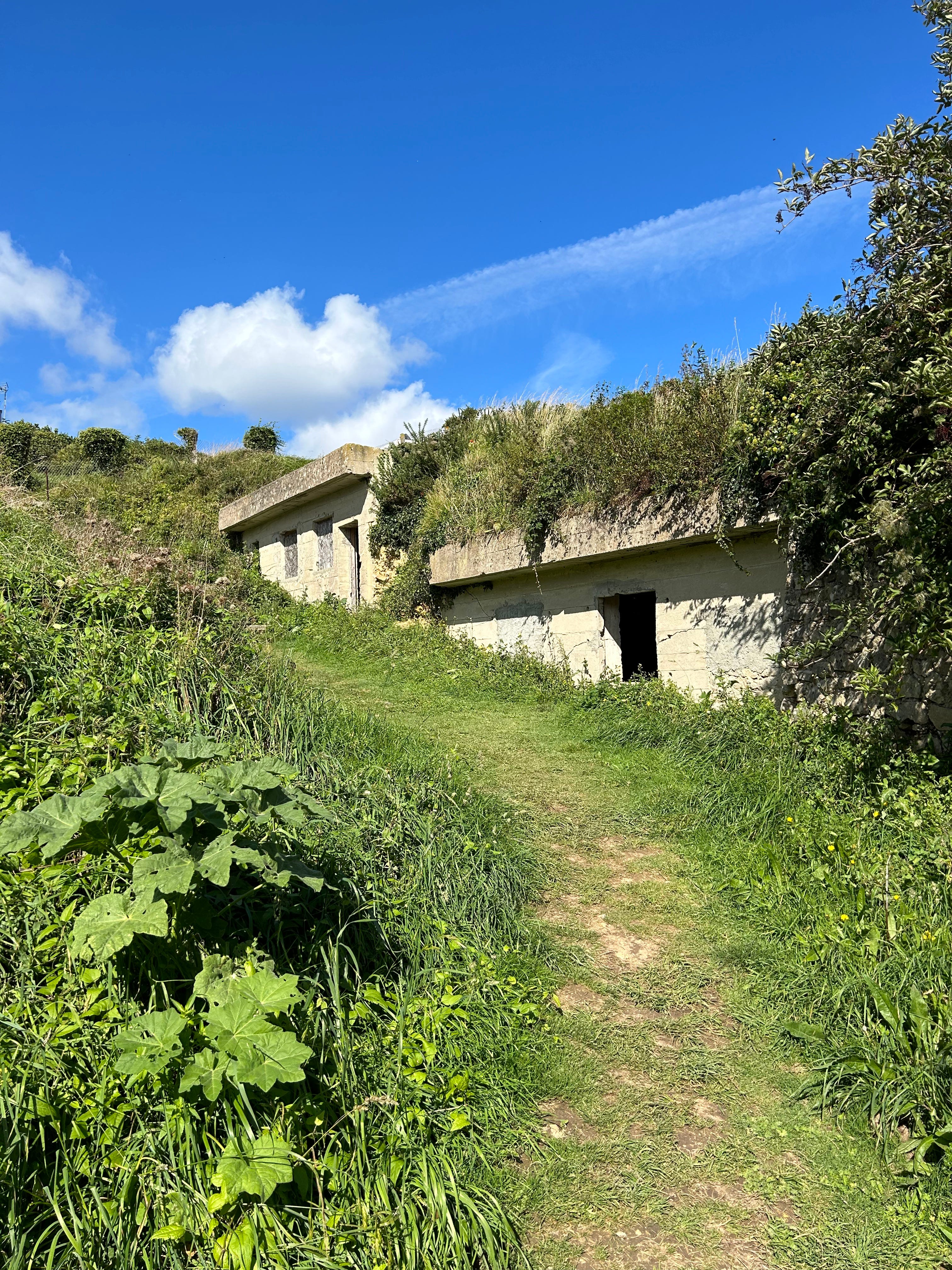
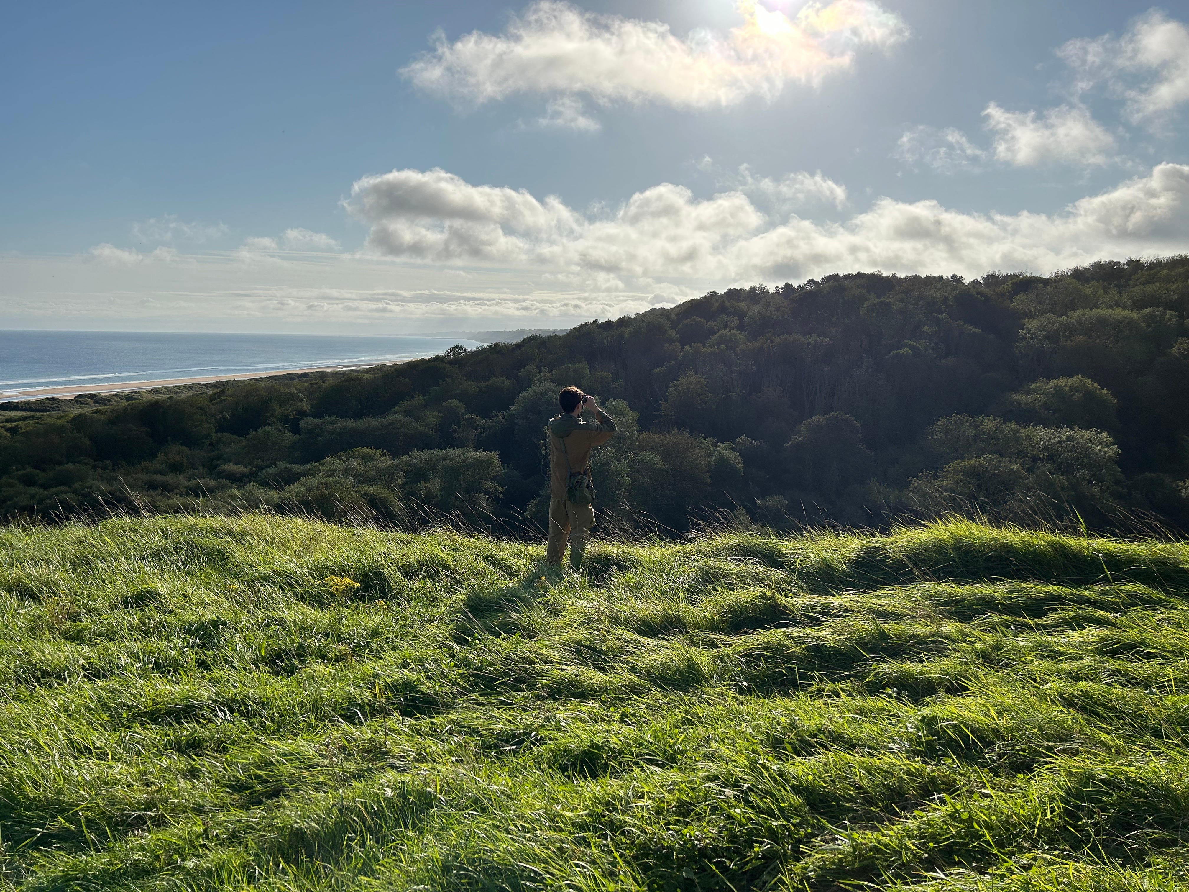
As we finished our exploration of the Colleville Draw, our son suggested a side trip to WN60, a few miles to the east. He wasn’t sure if it would be accessible, but Google Maps gave us hope that it would involve minimal trespassing. A key feature for me. What we found is probably the most well kept secret on Omaha Beach and a complete gem for any D-Day explorer.
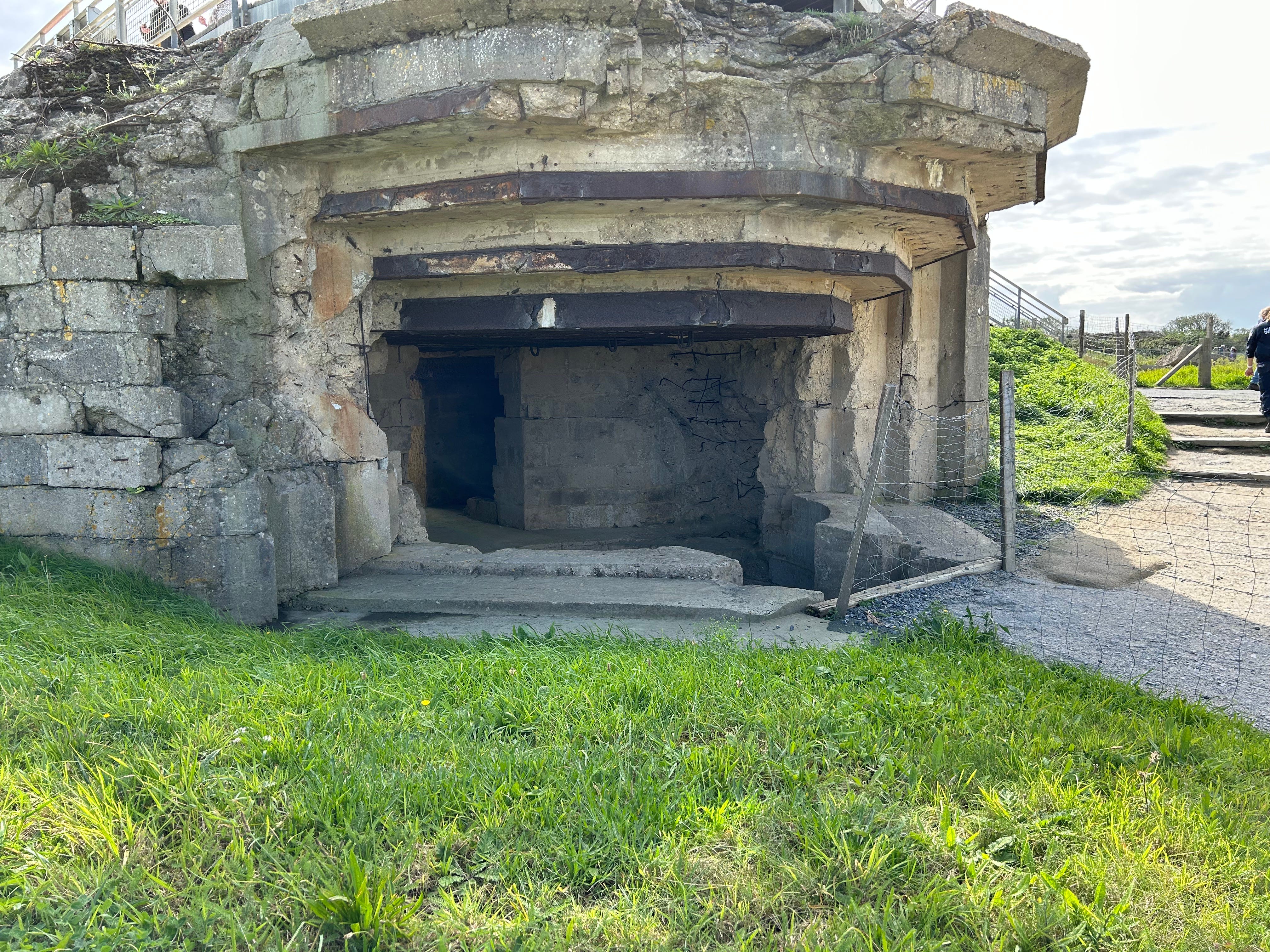
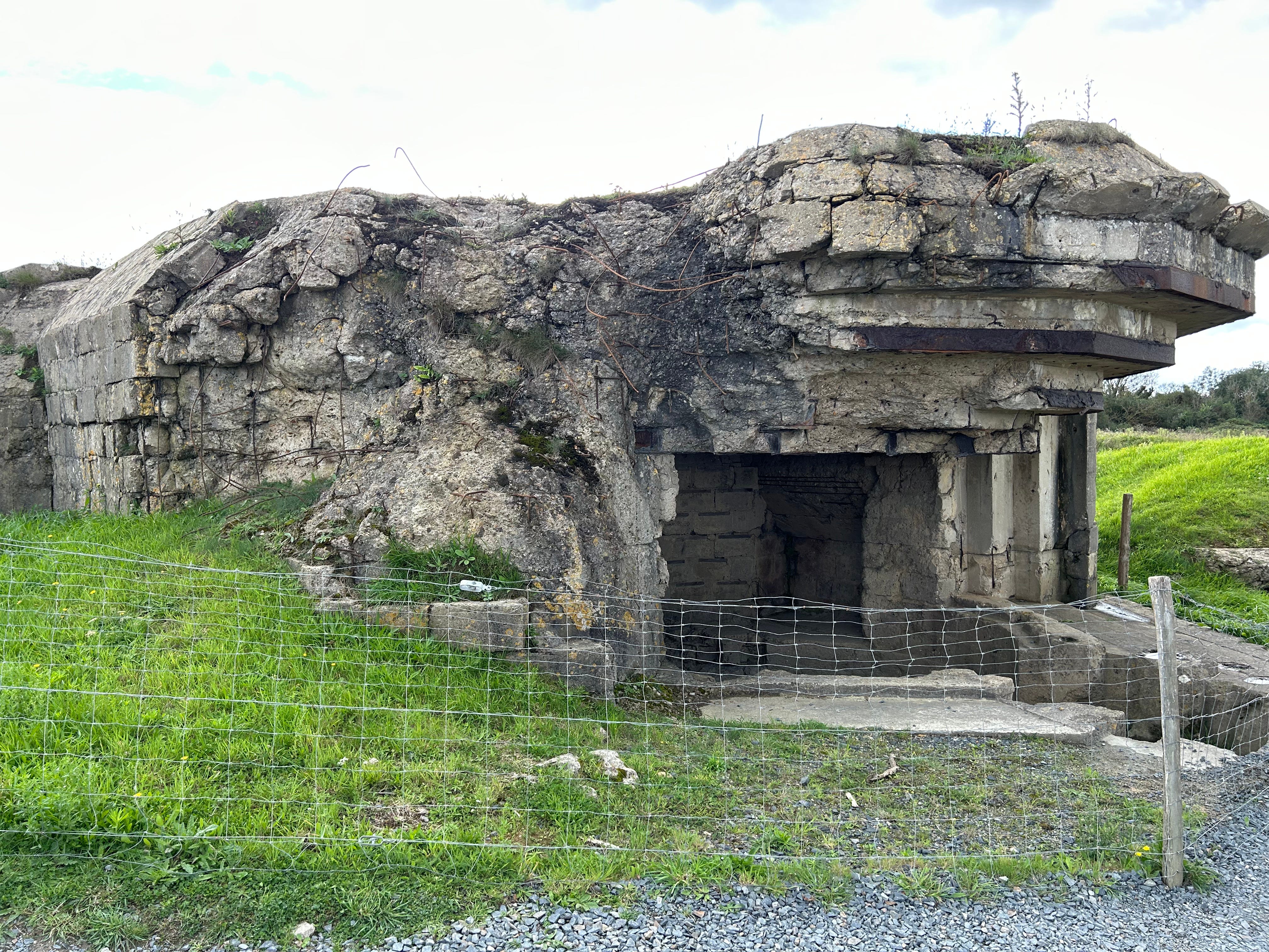
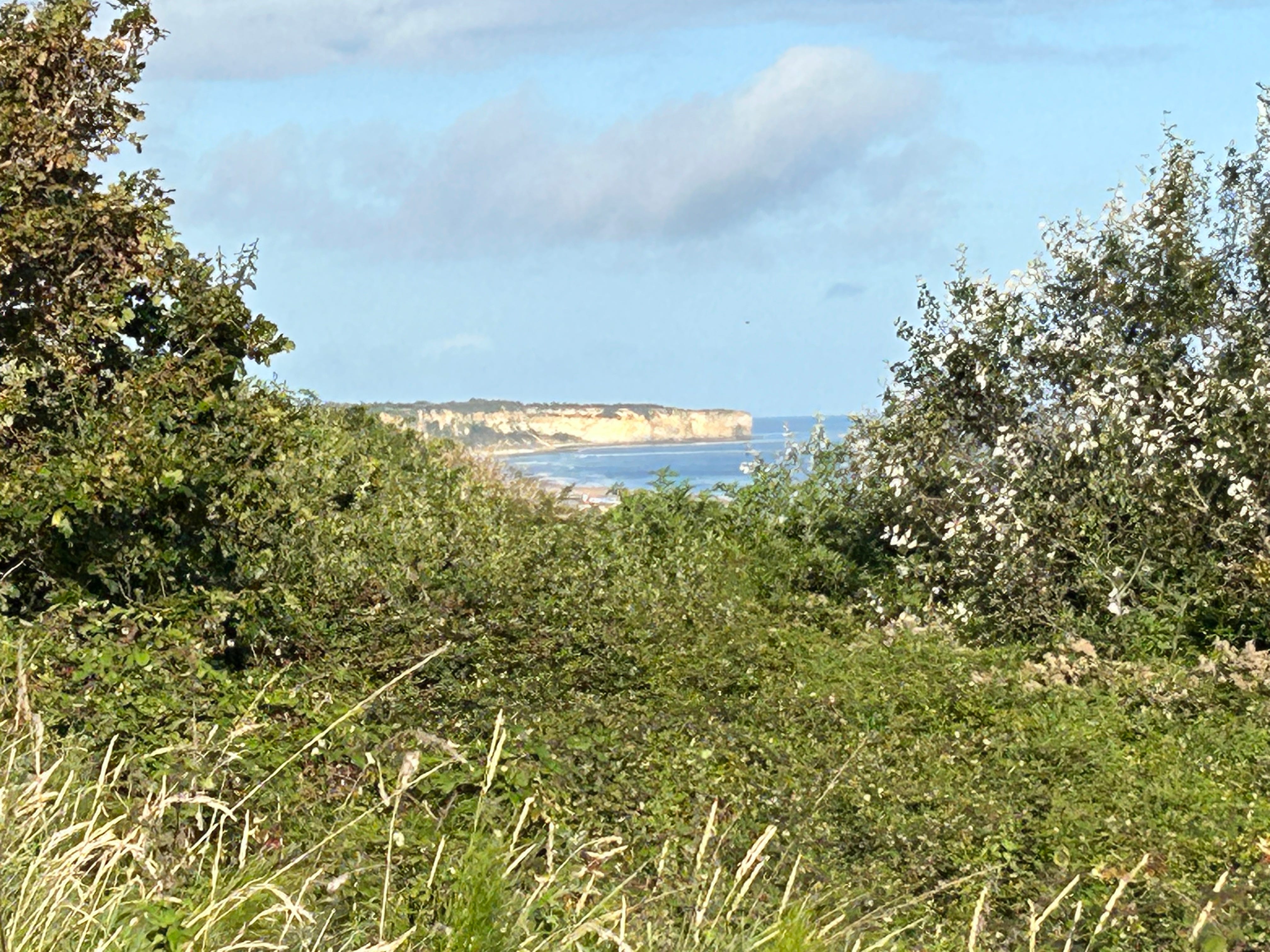
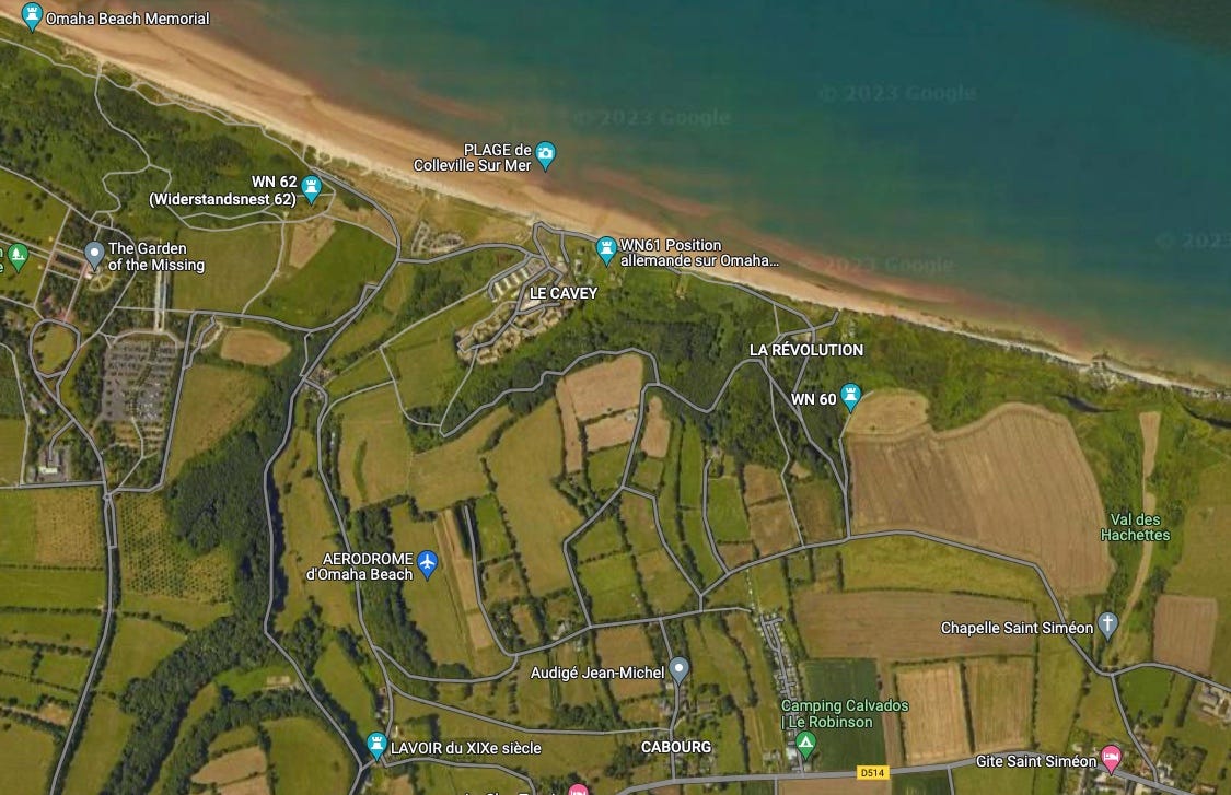
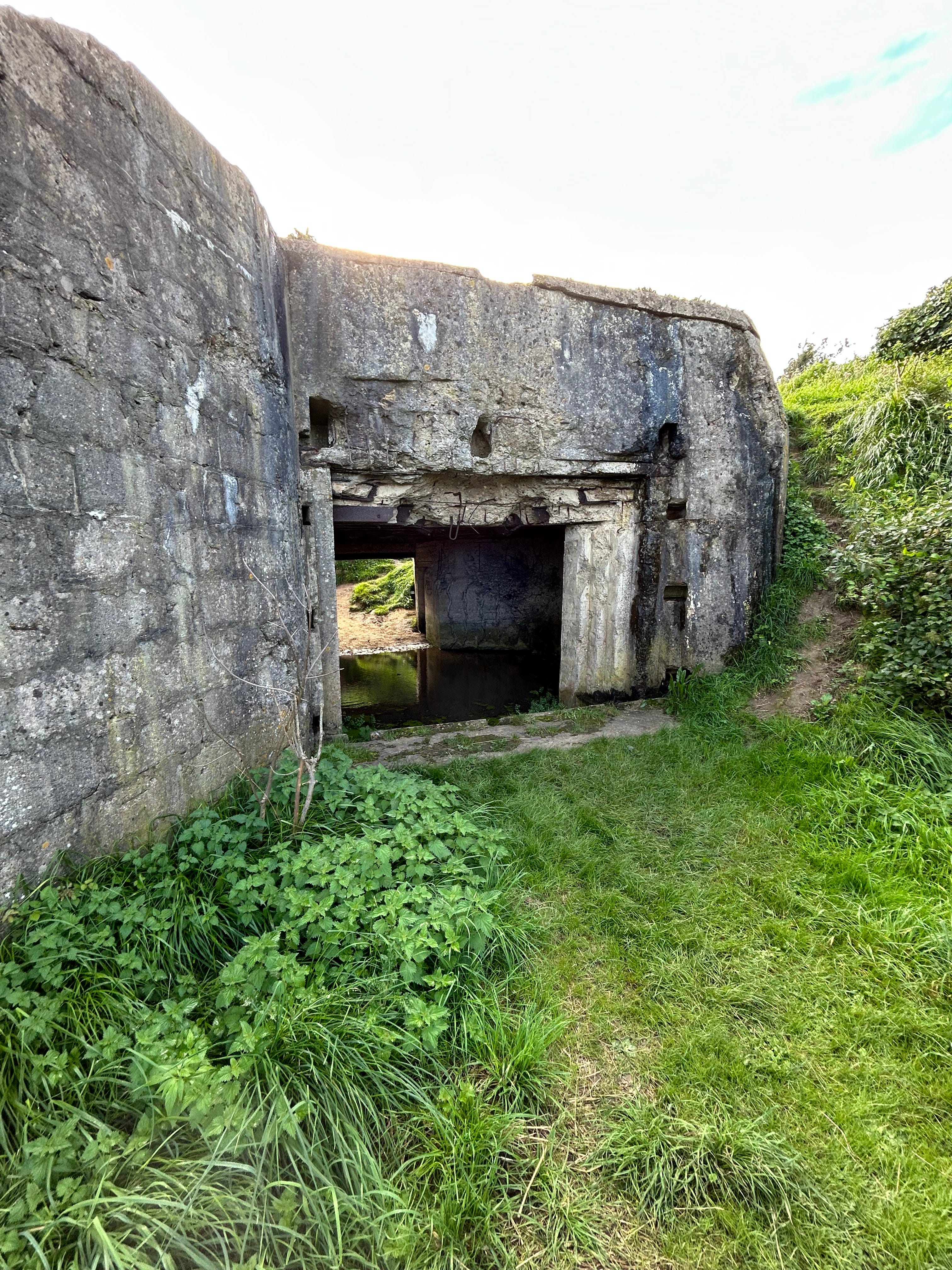
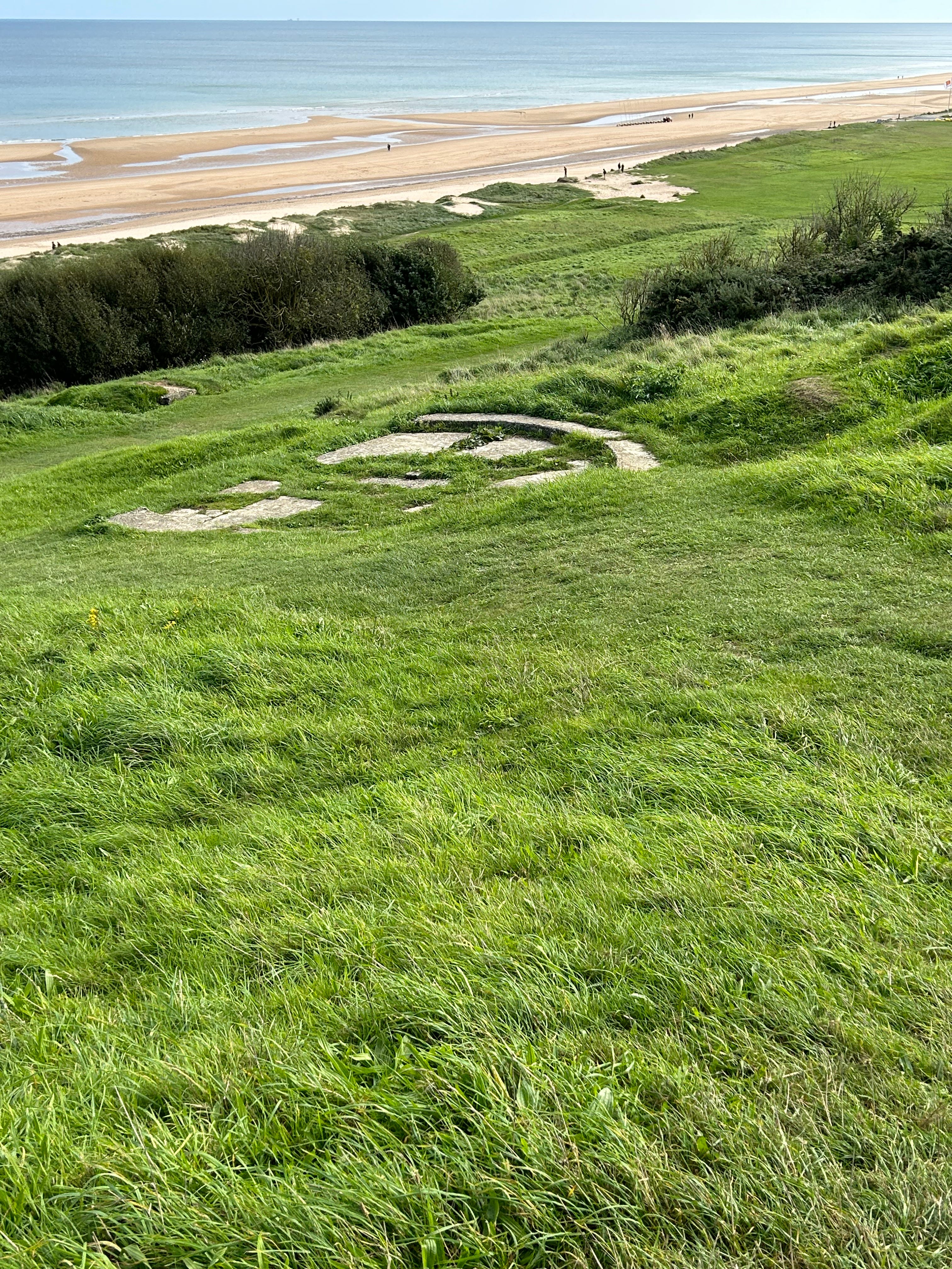
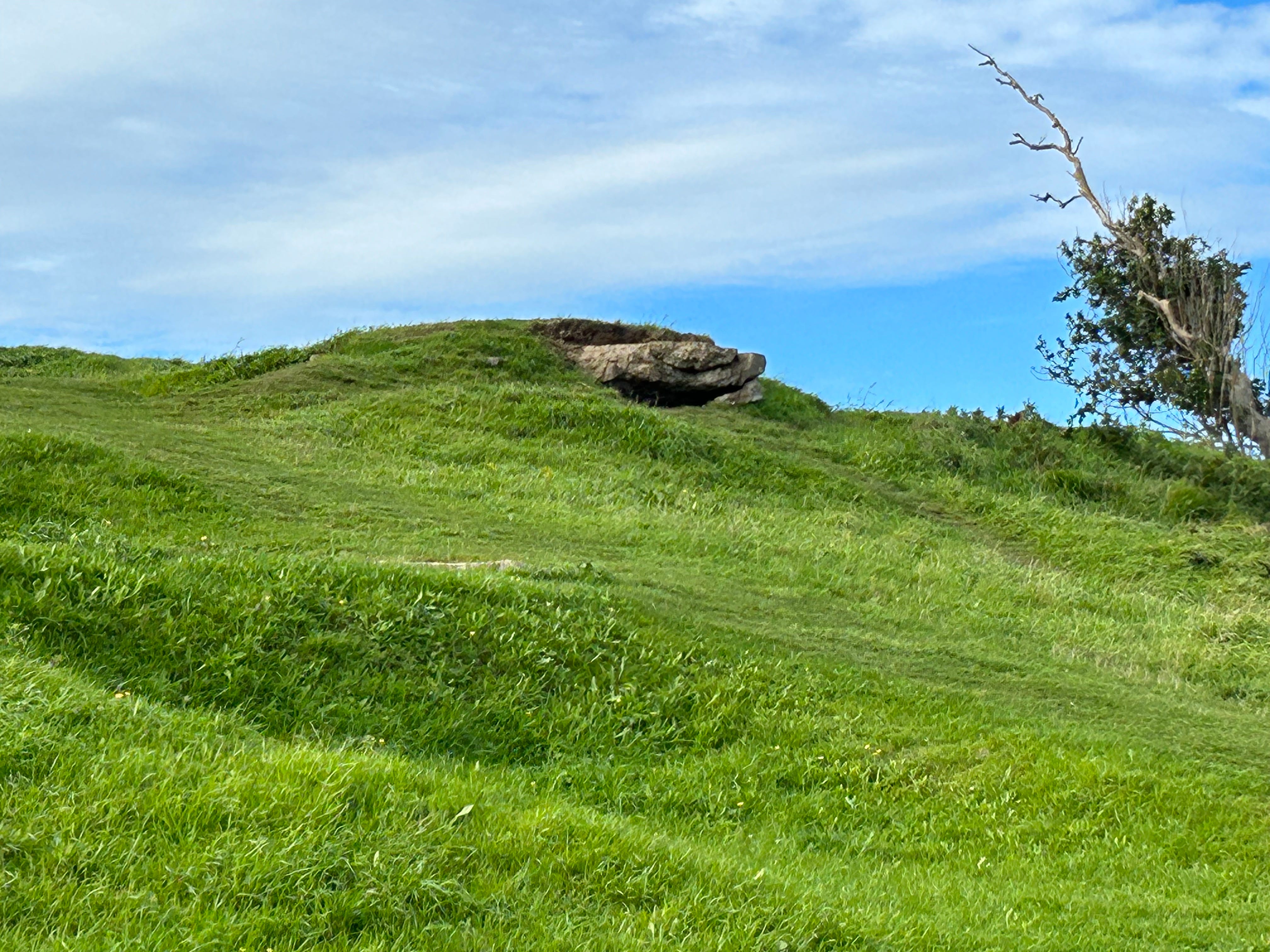
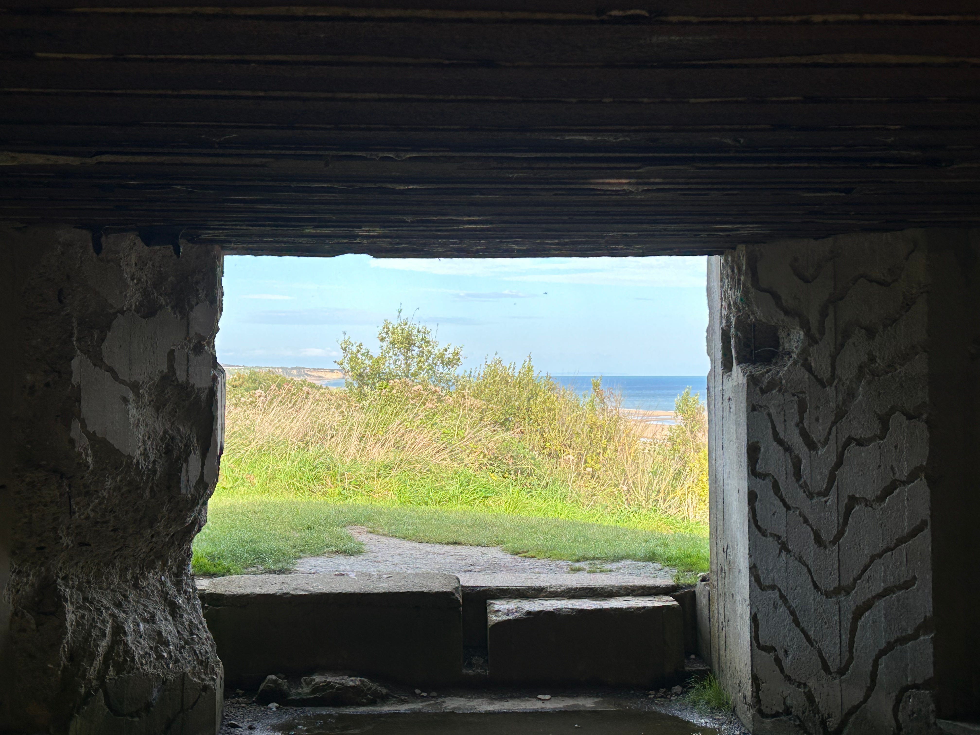
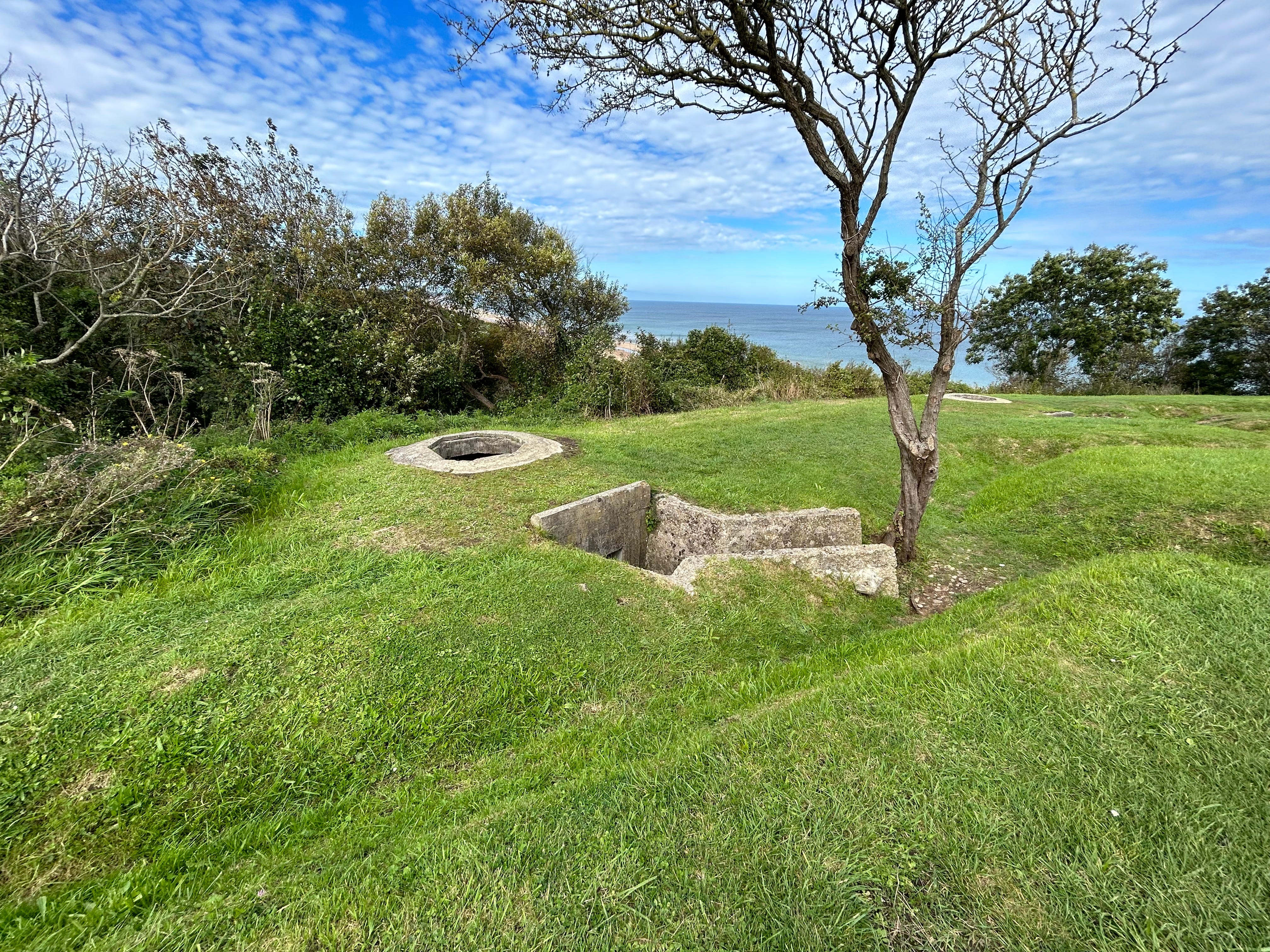
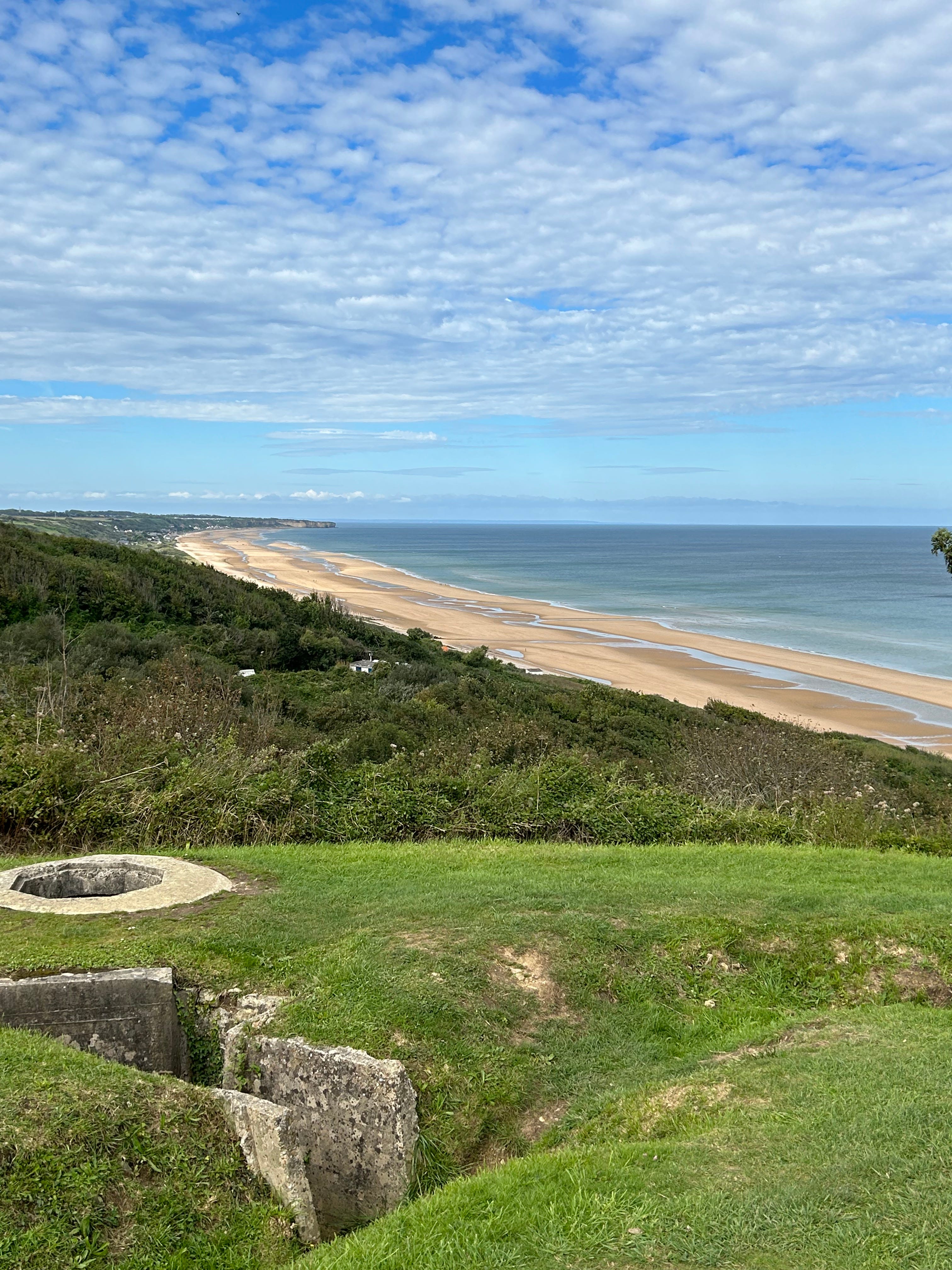
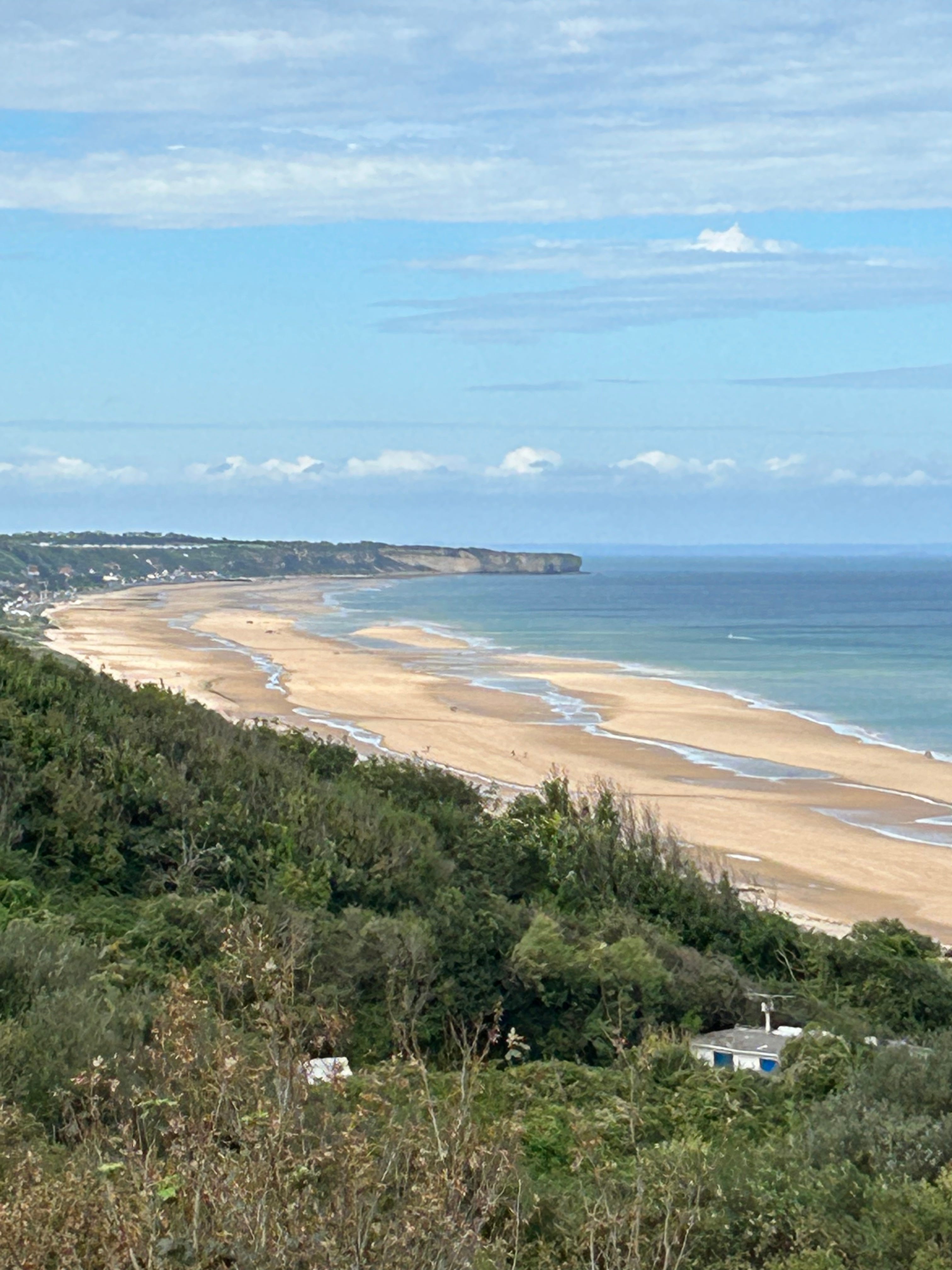
NUMBER 5 DRAW and WN60 (sometimes called the Cabourg Draw):
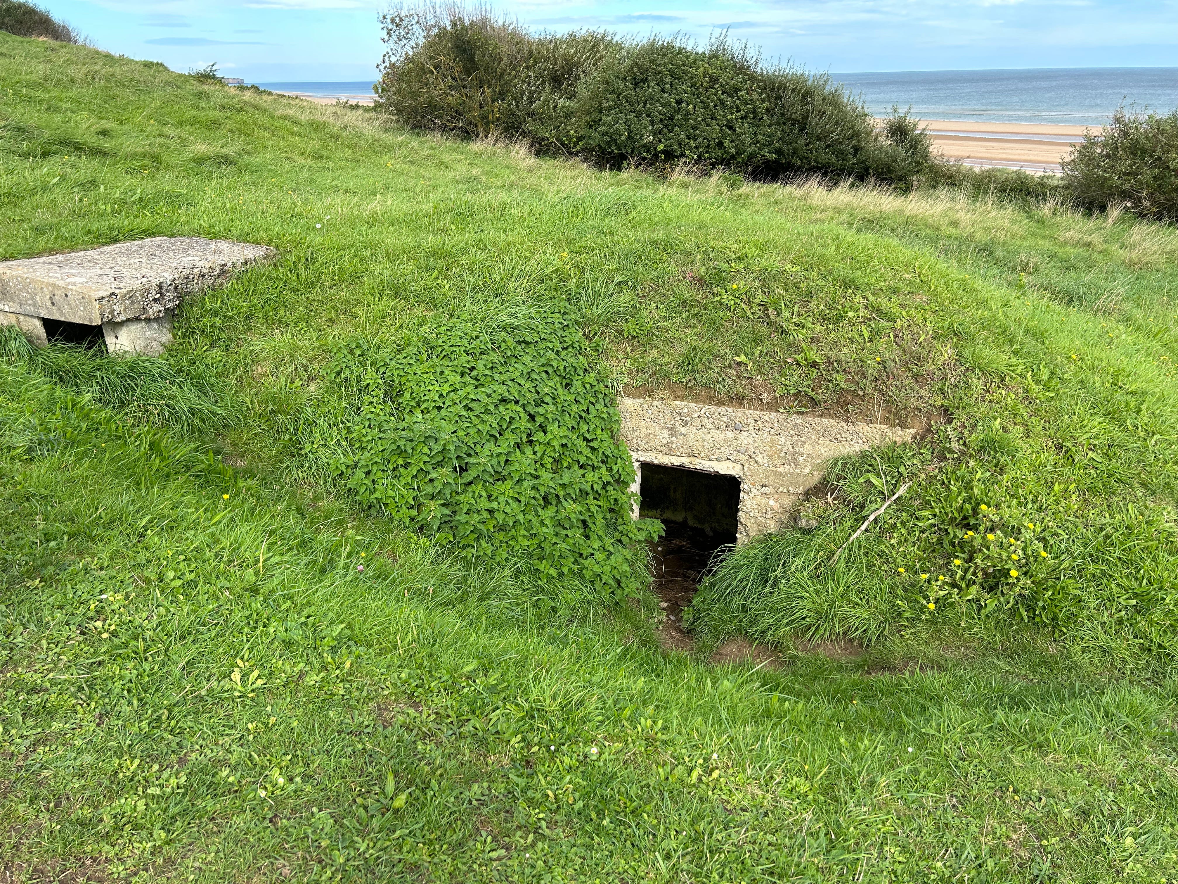
After driving down a one-lane road for several minutes, and having to negotiate tight passage with a few cars, we arrived at a wooden fence at the end of a dirt road. I thought it was literally the end of the road for us, but WN60 turned out to be an “official” historical site, so no trespassing…and nobody we came across during our travels had heard of it.
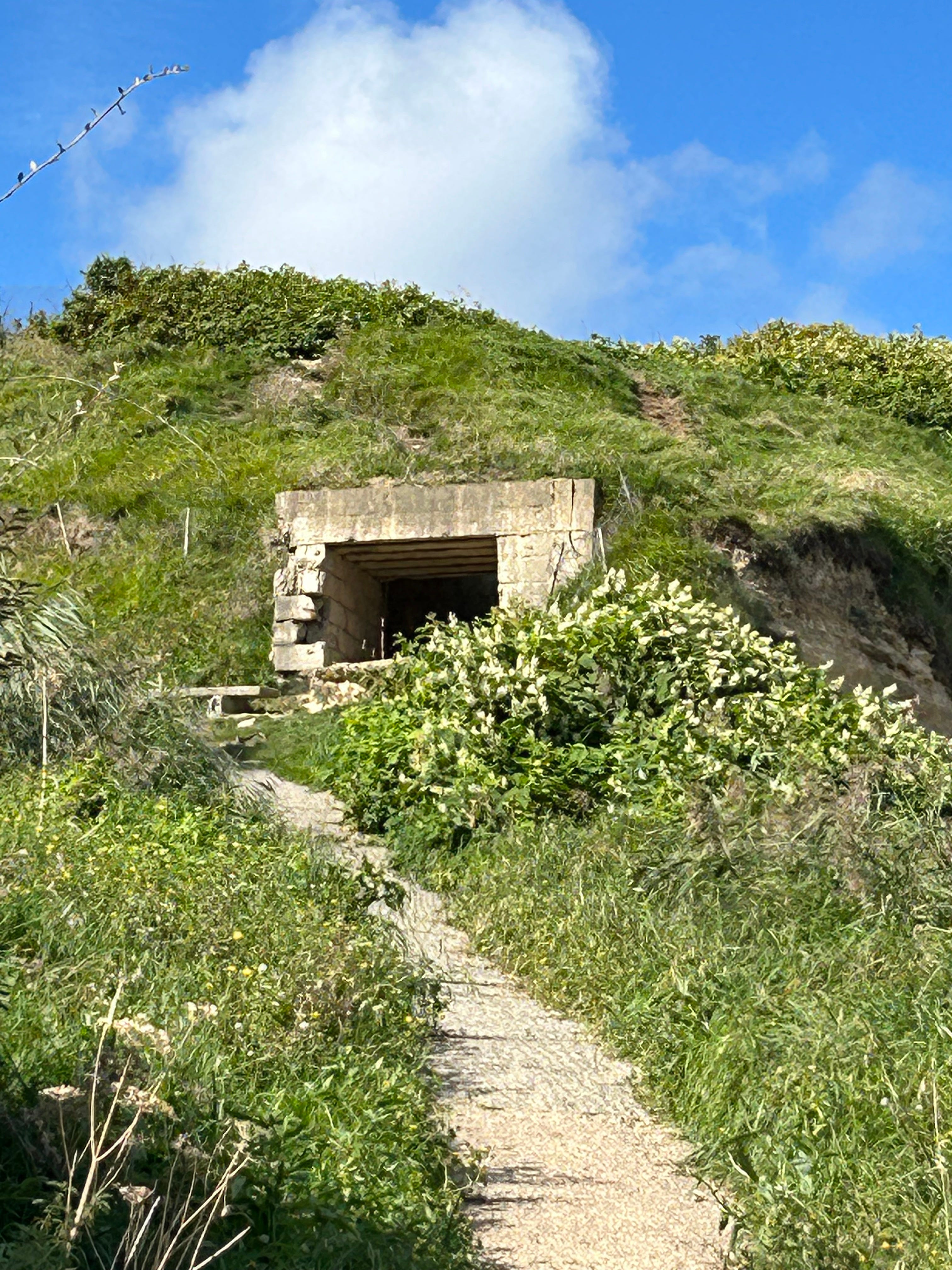
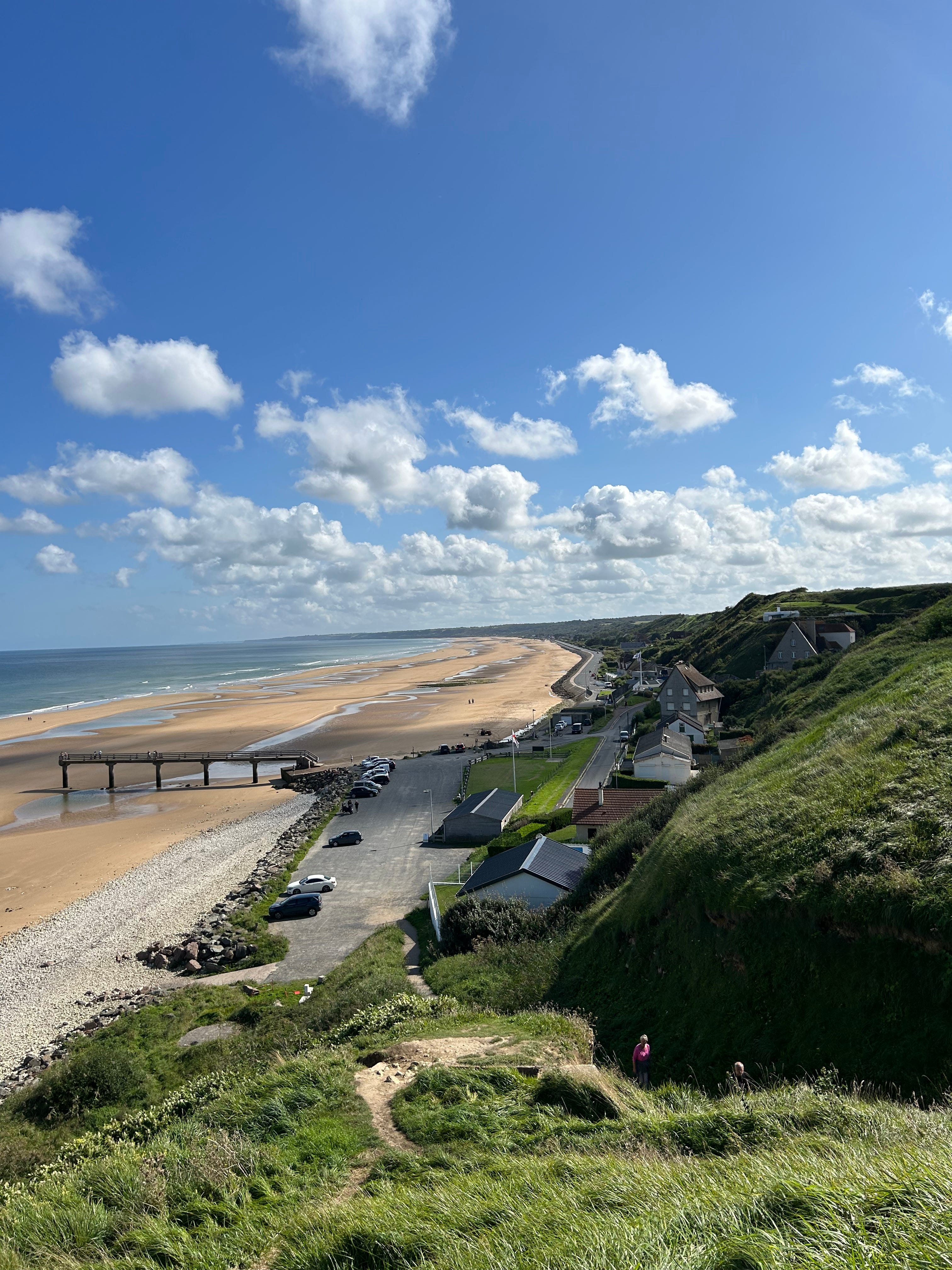
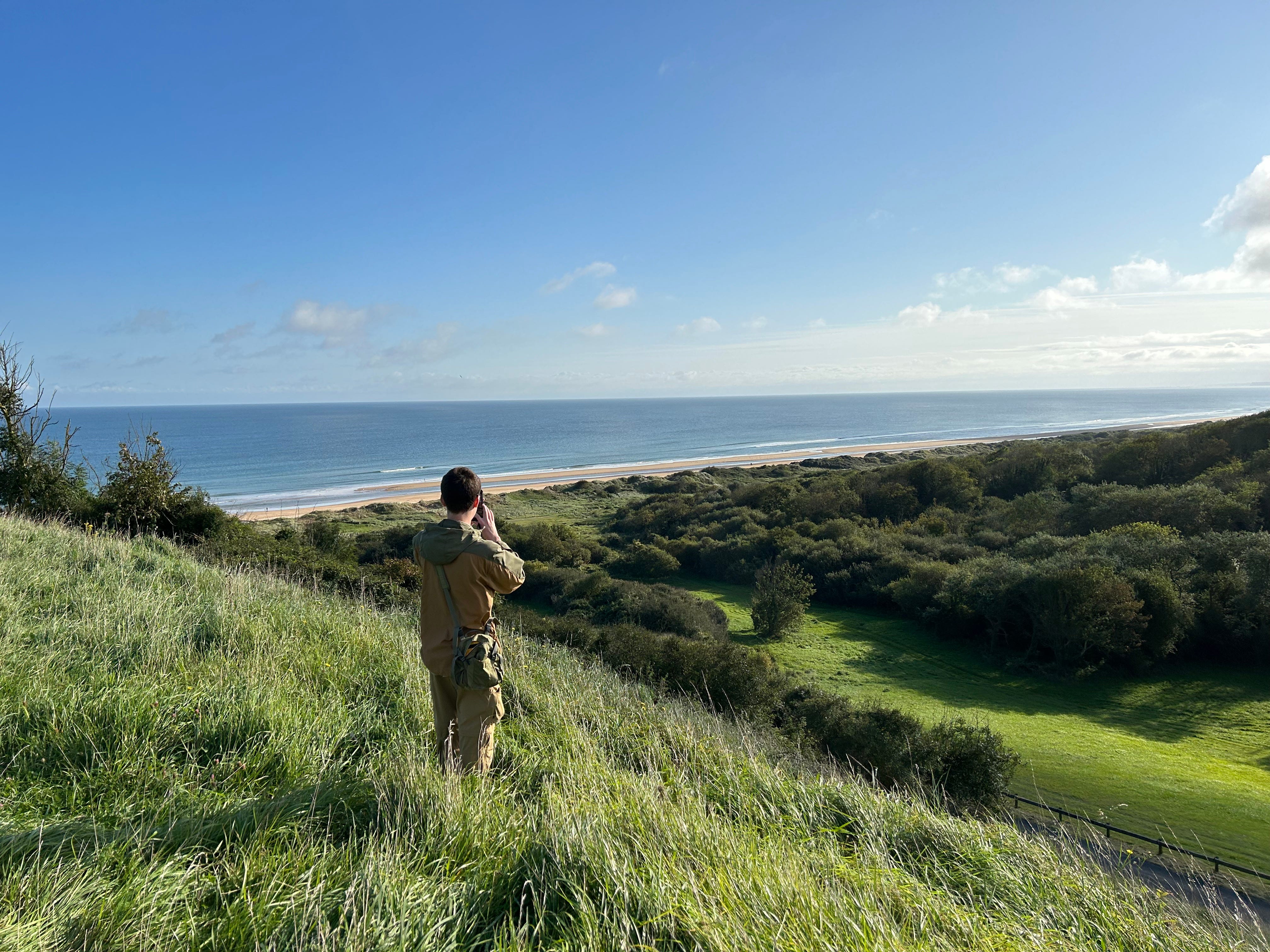
We found a number of intact and explorable fortifications here. Mortar and machine gun positions, plus a bunker. AND the view of Omaha Beach was unbeatable. The best by far. I say that lightly, because staring down the beach, you can imagine the havoc the mortars rained down on the beaches. A 75mm gun was positioned here as well. Fortunately, the site was neutralized quickly on the morning of D-Day.
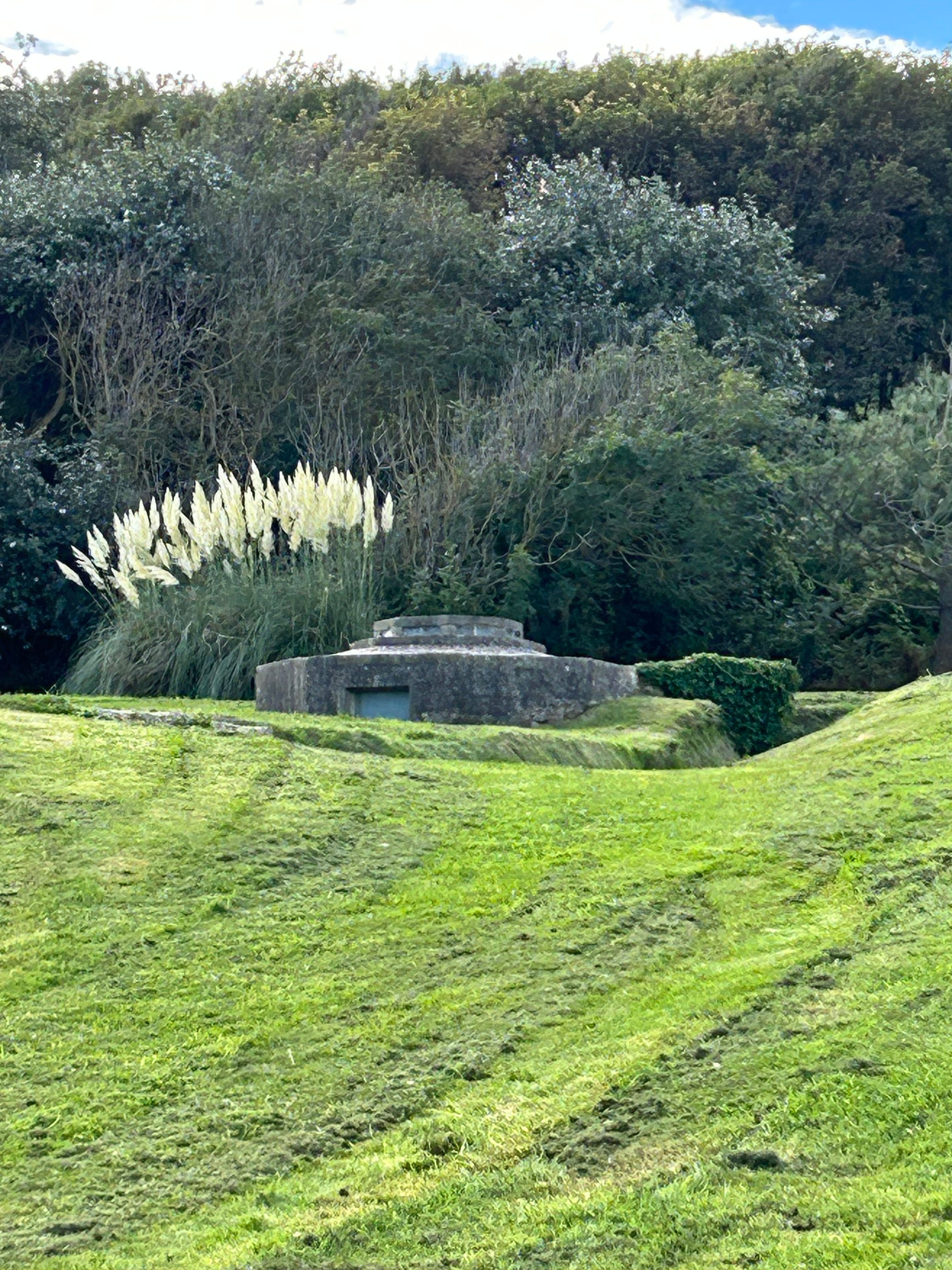
The octagonal fortifications housed mortars, which fired from below ground. They would be impervious to direct gun fire.
The beaches in front of Colleville Draw are visible beyond the trees, but as you’ll see a few more pictures down, WN60 had the ability to directly see and fire on all of Omaha Beach.
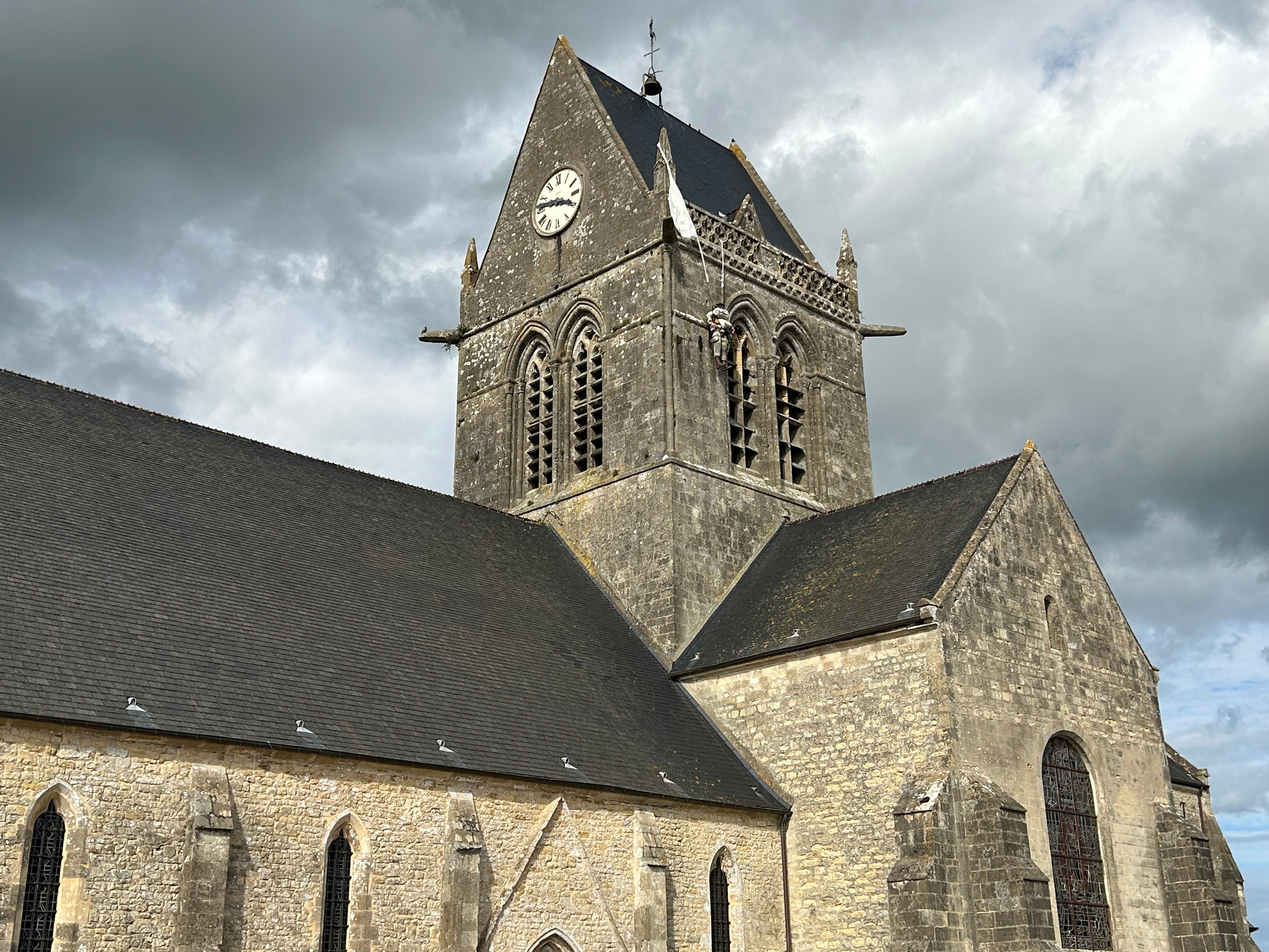
SAINTE MERE EGLISE:
We spent most of our time exploring the beach sites, but no trip to the area would be complete without visiting the epicenter of the Airborne landings. Both the 82nd Airborne and 101st Airborne had primary drop zones a few miles north of Sainte Mere Eglise. Unfortunately, many of the paratroopers landed miles from their intended drop zones. Some landed right in the town of Sainte Mere Eglise. The church off the town square features this memorial to the American soldiers who landed in town and were either captured or killed immediately. Private John Steele, whose parachute snagged on the church pinnacle, actually survived the night. He was captured and then escaped a few hours later to fight with his unit. He survived the war.
What we witnessed in Normandy was truly a once in a lifetime experience, made even more special by the detailed narration and description provided by our son. It was like having a personal tour guide, who knew more than any other tour guide in the area.
If you enjoyed these pictures, I may create a PART 2, with more photos of other sites and some of the French coast and countryside. Normandy is one of the most beautiful places we’ve visited, despite the dark history that hangs over the region.
Beautiful pictures. Captivating narrative-I couldn't stop reading. Thank you for sharing!
Definitely want to see Part II!